UN/LOCODE hub · Lebanon
LBLN8

Bekaa

34.0000°, 36.1333°
2
Transport functions

Transport Functions

Port
Road
UN/LOCODE

Hub Profile

Region
BI
GeoNames

Location

Location of LBLN8
Natural Earth 10m (public domain) · BI · LBLN8 · 34.00, 36.13GoogleOSMYandex

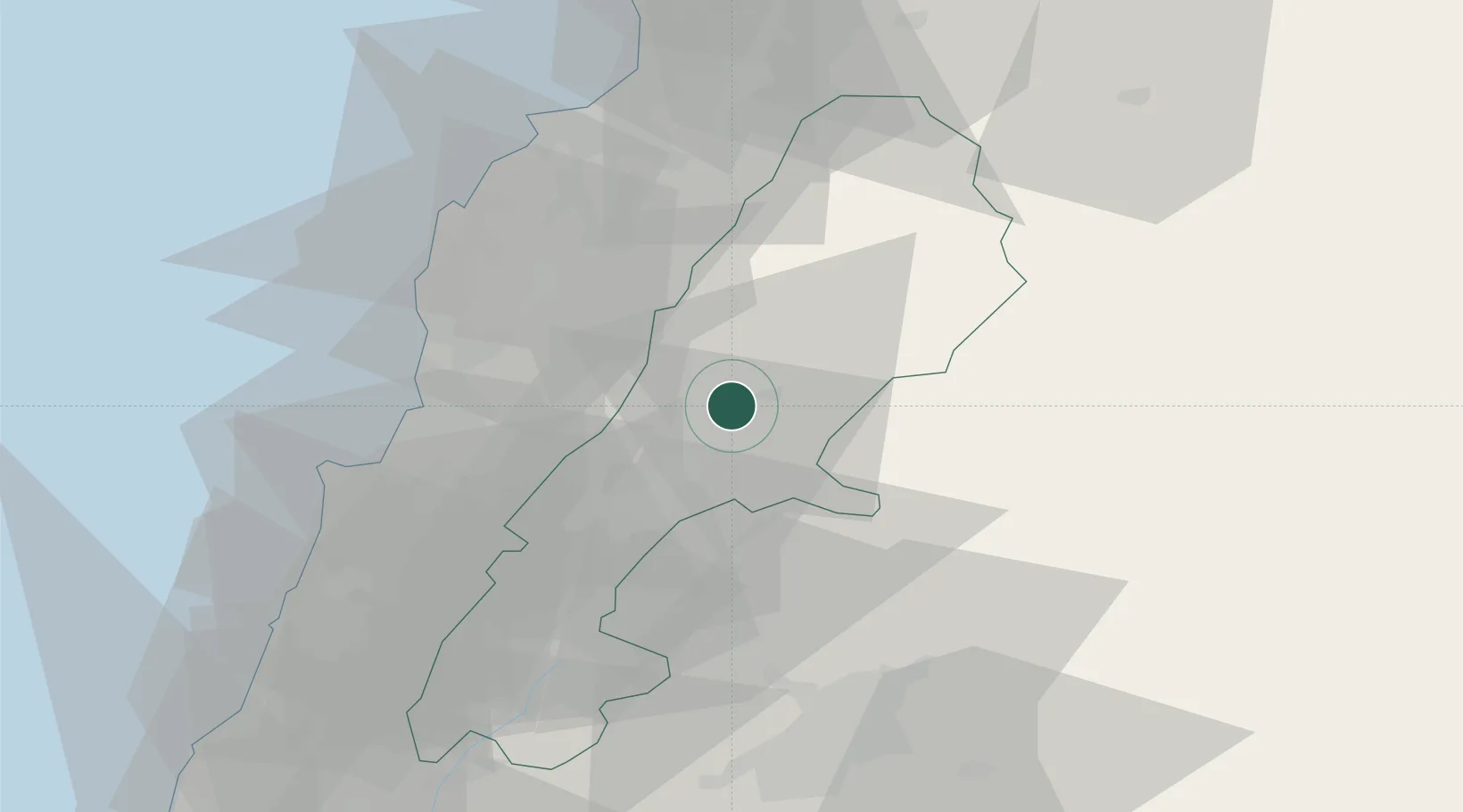
Nearby Logistics Neighbours

Cities
  1. 1'Ablah21 km
  2. 2Ashqout40 km
  3. 3Zouk46 km
  4. 4Byblos46 km
  5. 5Amchit49 km
Nearest neighbours — logibook spatial index (haversine) over the source coordinates
Ports
  1. 1Selaata54 km
  2. 2Tarabulus57 km
  3. 3Bayrut60 km
  4. 4Sayda91 km
  5. 5Sidon/zahrani Terminal92 km
Nearest neighbours — logibook spatial index (haversine) over the source coordinates
Airports
  1. 1Rayak Air Base21 km
  2. 2Wujah Al Hajar Air Base52 km
  3. 3Beirut Rafic Hariri International Airport63 km
  4. 4Rene Mouawad Air Base67 km
  5. 5An Nasiriyah Air Base68 km
Nearest neighbours — logibook spatial index (haversine) over the source coordinates
Trade Zones
  1. 1Damascus Free Zone56 km
  2. 2Tripoli Special Economic Zone57 km
  3. 3Port of Beirut Logistics Free Zone58 km
  4. 4Adra Free Zone60 km
  5. 5Damascus International Airport Free Zone74 km
Nearest neighbours — logibook spatial index (haversine) over the source coordinates
DatabookThe Record of Consolidated Knowledge
Lebanon beyond logistics?
Browse databook

All Sources

LocationsUN/LOCODE
UN/LOCODE — free
Portsthe NGA World Port Index
Public domain (US gov)
AirportsOurAirports
Public domain
Trade Zonesthe World Bank SEZ database
CC BY 4.0
Trade ZonesOpen Zone Map
CC BY
← Lebanon locations