Diversified Zone · Indonesia

Pulahan Seruai Industrial Estate Under Development

-7.2696°, 112.7152°
650 ha
Zone area
8.0 km
Nearest port
14.6 km
Nearest airport

Gateway access

Nearest neighbours — logibook spatial index (haversine) over the source coordinates

Zone profile

Zone type
Diversified Zone
Open Zone Map
Region
Jawa Timur
Open Zone Map
Status
Under Development
Open Zone Map
Management
Private
Open Zone Map
Operator
PT Lamhotma
Open Zone Map
Legal framework
The Law No 3. Article 106, issued in 2014
Open Zone Map

Location

Location of ozm-2394
Natural Earth 10m (public domain) · Jawa Timur · ozm-2394 · -7.27, 112.72GoogleOSMYandex

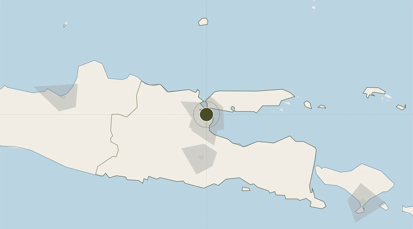
Nearby Logistics Neighbours

Ports
  1. 1Surabaya8 km
  2. 2Gresik15 km
  3. 3Poleng Oil Field72 km
  4. 4Probolinggo74 km
  5. 5Tuban86 km
Nearest neighbours — logibook spatial index (haversine) over the source coordinates
Airports
  1. 1Juanda International Airport15 km
  2. 2Abdul Rachman Saleh Airport73 km
  3. 3Dhoho International Airport100 km
  4. 4Notohadinegoro Airport153 km
  5. 5Banyuwangi Airport213 km
Nearest neighbours — logibook spatial index (haversine) over the source coordinates
Cities
  1. 1Surabaya5 km
  2. 2Gresik, Java15 km
  3. 3Manyar21 km
  4. 4Mojosari33 km
  5. 5Mojokerto38 km
Nearest neighbours — logibook spatial index (haversine) over the source coordinates
Trade Zones
  1. 1Surabaya Industrial Estate - Rungkut8 km
  2. 2Gresik Industrial Estate16 km
  3. 3Maspion Industrial Estate20 km
  4. 4Safe N Lock Industrial Estate22 km
  5. 5Java Integrated Industrial Estate24 km
Nearest neighbours — logibook spatial index (haversine) over the source coordinates
DatabookThe Record of Consolidated Knowledge
Indonesia beyond logistics?
Browse databook

All Sources

Trade ZonesOpen Zone Map
CC BY
Portsthe NGA World Port Index
Public domain (US gov)
AirportsOurAirports
Public domain
LocationsUN/LOCODE
UN/LOCODE — free
← Indonesia trade zones