UN/LOCODE hub · Indonesia
IDMYR

Manyar

-7.1167°, 112.6000°
1
Transport functions

Transport Functions

Multimodal
UN/LOCODE

Hub Profile

Place type
Populated place
GeoNames
Region
East Java
GeoNames
Time zone
Asia/Jakarta
GeoNames
Elevation
8 m
GeoNames

Location

Location of IDMYR
Natural Earth 10m (public domain) · East Java · IDMYR · -7.12, 112.60GoogleOSMYandex

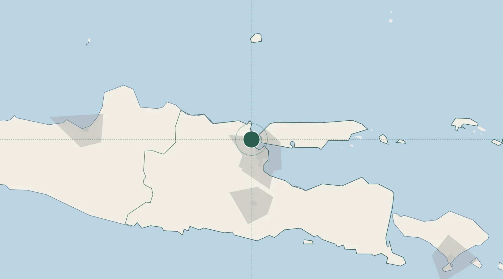
Nearby Logistics Neighbours

Cities
  1. 1Gresik, Java7 km
  2. 2Surabaya16 km
  3. 3Mojokerto43 km
  4. 4Mojosari45 km
  5. 5Madura Terminal49 km
Nearest neighbours — logibook spatial index (haversine) over the source coordinates
Ports
  1. 1Gresik7 km
  2. 2Surabaya17 km
  3. 3Poleng Oil Field63 km
  4. 4Tuban66 km
  5. 5Probolinggo95 km
Nearest neighbours — logibook spatial index (haversine) over the source coordinates
Airports
  1. 1Juanda International Airport36 km
  2. 2Abdul Rachman Saleh Airport91 km
  3. 3Dhoho International Airport101 km
  4. 4Notohadinegoro Airport174 km
  5. 5Adisumarmo Airport208 km
Nearest neighbours — logibook spatial index (haversine) over the source coordinates
Trade Zones
  1. 1Maspion Industrial Estate2 km
  2. 2Java Integrated Industrial Estate4 km
  3. 3Gresik Industrial Estate6 km
  4. 4Pulahan Seruai Industrial Estate21 km
  5. 5Surabaya Industrial Estate - Rungkut30 km
Nearest neighbours — logibook spatial index (haversine) over the source coordinates
DatabookThe Record of Consolidated Knowledge
Indonesia beyond logistics?
Browse databook

All Sources

LocationsUN/LOCODE
UN/LOCODE — free
Portsthe NGA World Port Index
Public domain (US gov)
AirportsOurAirports
Public domain
Trade Zonesthe World Bank SEZ database
CC BY 4.0
Trade ZonesOpen Zone Map
CC BY
← Indonesia locations