UN/LOCODE hub · Indonesia
IDMJI

Mojosari

-7.5167°, 112.5500°
2
Transport functions

Transport Functions

Rail
Road
UN/LOCODE

Hub Profile

Place type
Provincial seat
GeoNames
Region
East Java
GeoNames
Time zone
Asia/Jakarta
GeoNames
Elevation
32 m
GeoNames

Location

Location of IDMJI
Natural Earth 10m (public domain) · East Java · IDMJI · -7.52, 112.55GoogleOSMYandex

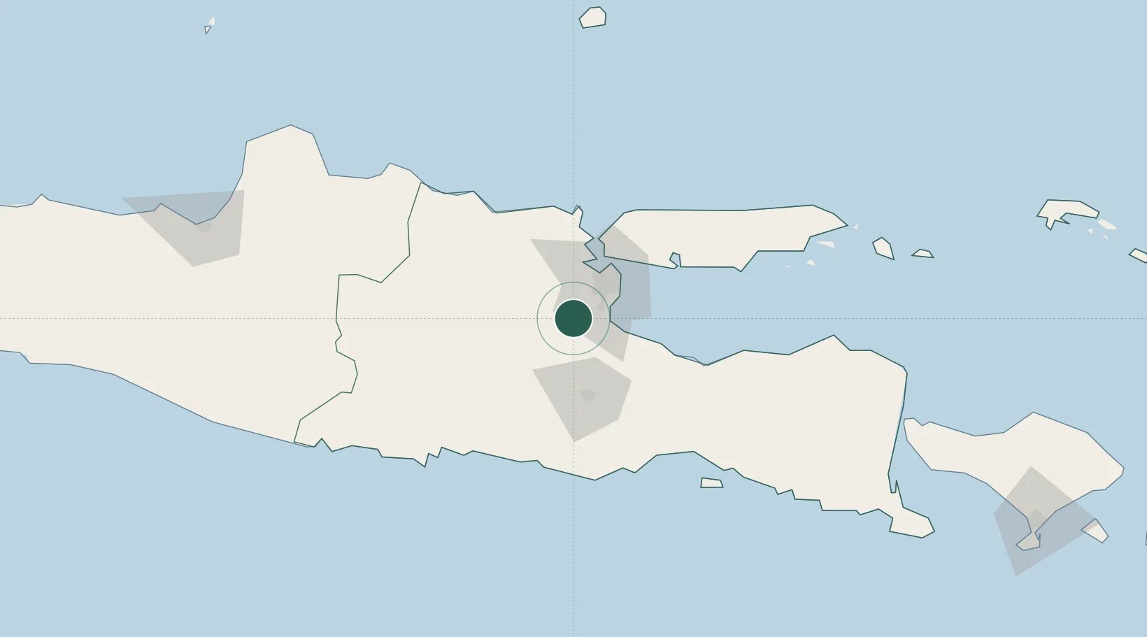
Nearby Logistics Neighbours

Cities
  1. 1Mojokerto14 km
  2. 2Jawa Timur25 km
  3. 3Purwosari34 km
  4. 4Jombang35 km
  5. 5Surabaya36 km
Nearest neighbours — logibook spatial index (haversine) over the source coordinates
Ports
  1. 1Surabaya41 km
  2. 2Gresik42 km
  3. 3Probolinggo77 km
  4. 4Tuban98 km
  5. 5Poleng Oil Field105 km
Nearest neighbours — logibook spatial index (haversine) over the source coordinates
Airports
  1. 1Juanda International Airport30 km
  2. 2Abdul Rachman Saleh Airport49 km
  3. 3Dhoho International Airport71 km
  4. 4Notohadinegoro Airport150 km
  5. 5Adisumarmo Airport198 km
Nearest neighbours — logibook spatial index (haversine) over the source coordinates
Trade Zones
  1. 1Ngoro Industrial Park9 km
  2. 2Safe N Lock Industrial Estate23 km
  3. 3Surabaya Industrial Estate - Rungkut31 km
  4. 4Pasuruan Industrial Estate Rembang32 km
  5. 5Pulahan Seruai Industrial Estate33 km
Nearest neighbours — logibook spatial index (haversine) over the source coordinates
DatabookThe Record of Consolidated Knowledge
Indonesia beyond logistics?
Browse databook

All Sources

LocationsUN/LOCODE
UN/LOCODE — free
Portsthe NGA World Port Index
Public domain (US gov)
AirportsOurAirports
Public domain
Trade Zonesthe World Bank SEZ database
CC BY 4.0
Trade ZonesOpen Zone Map
CC BY
← Indonesia locations