UN/LOCODE hub · Indonesia
IDGRE

Gresik, Java

-7.1500°, 112.6500°
2
Transport functions

Transport Functions

Port
Road
Gresik, Java is also a profiled seaport →
UN/LOCODE

Hub Profile

Region
JI
GeoNames

Location

Location of IDGRE
Natural Earth 10m (public domain) · JI · IDGRE · -7.15, 112.65GoogleOSMYandex

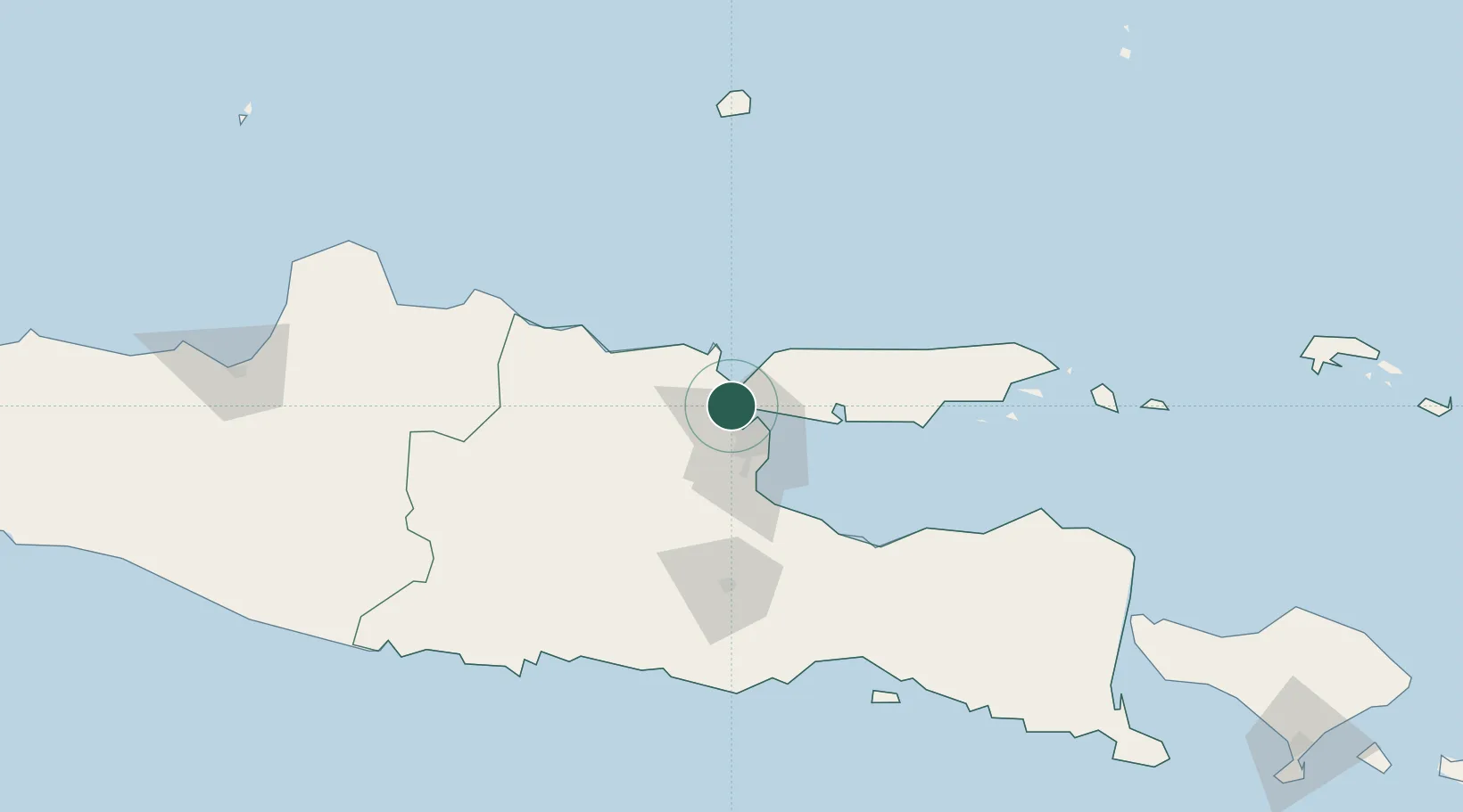
Nearby Logistics Neighbours

Cities
  1. 1Manyar7 km
  2. 2Surabaya10 km
  3. 3Mojosari42 km
  4. 4Mojokerto43 km
  5. 5Madura Terminal47 km
Nearest neighbours — logibook spatial index (haversine) over the source coordinates
Ports
  1. 1Surabaya11 km
  2. 2Poleng Oil Field63 km
  3. 3Tuban72 km
  4. 4Probolinggo89 km
  5. 5Rembang152 km
Nearest neighbours — logibook spatial index (haversine) over the source coordinates
Airports
  1. 1Juanda International Airport30 km
  2. 2Abdul Rachman Saleh Airport87 km
  3. 3Dhoho International Airport102 km
  4. 4Notohadinegoro Airport167 km
  5. 5Adisumarmo Airport213 km
Nearest neighbours — logibook spatial index (haversine) over the source coordinates
Trade Zones
  1. 1Gresik Industrial Estate2 km
  2. 2Maspion Industrial Estate5 km
  3. 3Java Integrated Industrial Estate9 km
  4. 4Pulahan Seruai Industrial Estate15 km
  5. 5Surabaya Industrial Estate - Rungkut23 km
Nearest neighbours — logibook spatial index (haversine) over the source coordinates
DatabookThe Record of Consolidated Knowledge
Indonesia beyond logistics?
Browse databook

All Sources

LocationsUN/LOCODE
UN/LOCODE — free
Portsthe NGA World Port Index
Public domain (US gov)
AirportsOurAirports
Public domain
Trade Zonesthe World Bank SEZ database
CC BY 4.0
Trade ZonesOpen Zone Map
CC BY
← Indonesia locations