Free Trade Zone · Colombia

Zona Franca Andina Inactive

5.0703°, -75.5138°
216.9 km
Nearest port
7.1 km
Nearest airport

Gateway access

Nearest neighbours — logibook spatial index (haversine) over the source coordinates

Zone profile

Zone type
Free Trade Zone
Open Zone Map
Region
Caldas
Open Zone Map
Status
Inactive
Open Zone Map
Management
Private
Open Zone Map
Operator
Zona Franca Andina/Infi-Manizales
Open Zone Map
Legal framework
Law 1004/2005 Decree 383 and 4051
Open Zone Map

Location

Location of ozm-1673
Natural Earth 10m (public domain) · Caldas · ozm-1673 · 5.07, -75.51GoogleOSMYandex

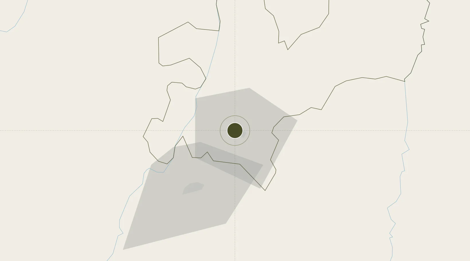
Nearby Logistics Neighbours

Ports
  1. 1Buenaventura217 km
  2. 2Turbo361 km
  3. 3Covenas484 km
  4. 4Covenas Offshore Term.493 km
  5. 5Tumaco510 km
Nearest neighbours — logibook spatial index (haversine) over the source coordinates
Airports
  1. 1La Nubia Airport7 km
  2. 2Matecaña International Airport38 km
  3. 3Santa Ana Airport60 km
  4. 4Mariquita Airport72 km
  5. 5El Eden Airport74 km
Nearest neighbours — logibook spatial index (haversine) over the source coordinates
Cities
  1. 1Chinchina15 km
  2. 2Galicia117 km
  3. 3Rionegro121 km
  4. 4Itagui122 km
  5. 5Espinal124 km
Nearest neighbours — logibook spatial index (haversine) over the source coordinates
Trade Zones
  1. 1Pereira International Free Trade Zone45 km
  2. 2Quindío Zona Franca74 km
  3. 3Zona Franca de Ibagué91 km
  4. 4Zona Franca Internacional Del Valle De Aburrá112 km
  5. 5Zona Franca Rio Negro121 km
Nearest neighbours — logibook spatial index (haversine) over the source coordinates
DatabookThe Record of Consolidated Knowledge
Colombia beyond logistics?
Browse databook

All Sources

Trade ZonesOpen Zone Map
CC BY
Portsthe NGA World Port Index
Public domain (US gov)
AirportsOurAirports
Public domain
LocationsUN/LOCODE
UN/LOCODE — free
← Colombia trade zones