Seaport · Panama

Bocas Del ToroPABOC

9.3333°, -82.2333°
7.9 m
Channel depth
Bocas Del Toro is also a UN/LOCODE logistics hub →

Channel & Berth Profile

SEA LEVEL (CD)CHANNEL BEDAnchorage · 4.0 mCargo pier · 6.4 mChannel · 7.9 m
NGA World Port Index

Pilotage, Tugs & Services

Pilotage compulsoryYES
Pilotage availableYES
Tug assistanceNO
Potable waterYES
Diesel bunkersYES
MedicalYES
NGA World Port Index

Facilities & Capabilities

Container
Ro-RoYES
Liquid bulk
Dry bulkYES
Oil terminal
Break bulkYES
Dry dock
Repairs
BunkeringYES
Rail link
Dangerous cargo
ISPS security
NGA World Port Index

Harbour Specifications

Harbour size
Very Small
NGA World Port Index
Harbour type
Open Roadstead
NGA World Port Index
Shelter
Fair
NGA World Port Index
Water body
Caribbean Sea; North Atlantic Ocean
NGA World Port Index
Tidal range
0.3 m
NGA World Port Index
Overhead limit
No
NGA World Port Index
Pilotage
Yes
NGA World Port Index

Location

Location of PABOC
Natural Earth 10m (public domain) · Bocas del Toro · PABOC · 9.33, -82.23GoogleOSMYandex

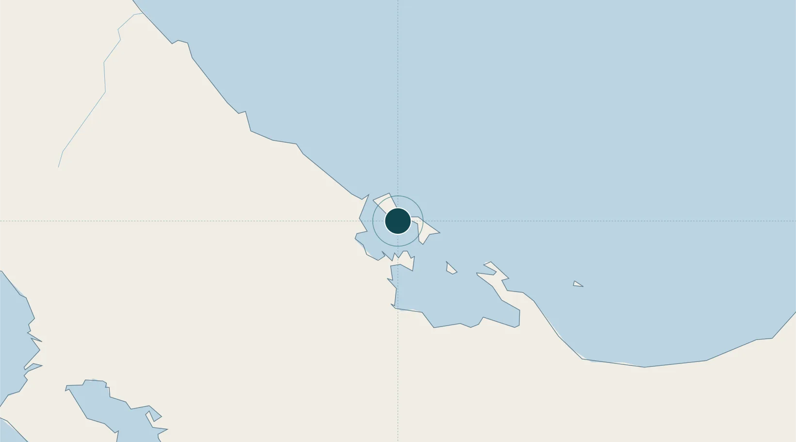
Nearby Logistics Neighbours

Ports
  1. 1Almirante19 km
  2. 2Chiriqui Grande45 km
  3. 3Pedregal112 km
  4. 4Puerto Limon112 km
  5. 5Puerto Moin119 km
Nearest neighbours — logibook spatial index (haversine) over the source coordinates
Cities
  1. 1Almirante18 km
  2. 2Chiriquí Grande45 km
  3. 3Sixaola/Talamanca47 km
  4. 4Puerto Viejo68 km
  5. 5Gualaca89 km
Nearest neighbours — logibook spatial index (haversine) over the source coordinates
Airports
  1. 1Bocas del Toro "Isla Colón" International Airport2 km
  2. 2Changuinola Captain Manuel Niño International Airport34 km
  3. 3Enrique Malek International Airport107 km
  4. 4Limón International Airport111 km
  5. 5Coto 47 Airport115 km
Nearest neighbours — logibook spatial index (haversine) over the source coordinates
Trade Zones
  1. 1Caribe Industrial Park & Free Zone121 km
  2. 2Baru Free Zone (Tourist and Multimodal Logistics Support Zone)137 km
  3. 3FreeHold Free Zone160 km
  4. 4Zeta Free Zone Catargo197 km
  5. 5Lima Free Zone and Business Park198 km
Nearest neighbours — logibook spatial index (haversine) over the source coordinates
DatabookThe Record of Consolidated Knowledge
Panama beyond logistics?
Browse databook

All Sources

Portsthe NGA World Port Index
Public domain (US gov)
AirportsOurAirports
Public domain
LocationsUN/LOCODE
UN/LOCODE — free
Trade Zonesthe World Bank SEZ database
CC BY 4.0
Trade ZonesOpen Zone Map
CC BY
← Panama ports