UN/LOCODE hub · Costa Rica
CRVDT

Puerto Viejo

9.6500°, -82.7667°
2
Transport functions

Transport Functions

Port
Road
UN/LOCODE

Hub Profile

Place type
Populated place
GeoNames
Region
Guanacaste Province
GeoNames
Time zone
America/Costa_Rica
GeoNames
Elevation
13 m
GeoNames

Location

Location of CRVDT
Natural Earth 10m (public domain) · Guanacaste Province · CRVDT · 9.65, -82.77GoogleOSMYandex

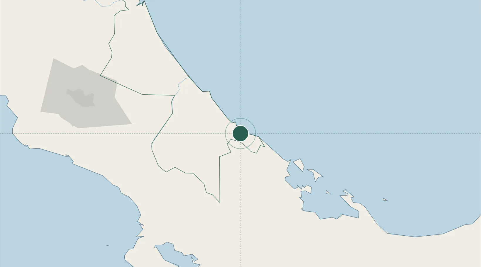
Nearby Logistics Neighbours

Cities
  1. 1Sixaola/Talamanca22 km
  2. 2Aguas Zarcas49 km
  3. 3Puerto Limón52 km
  4. 4Moín53 km
  5. 5Limon57 km
Nearest neighbours — logibook spatial index (haversine) over the source coordinates
Ports
  1. 1Puerto Limon46 km
  2. 2Puerto Moin52 km
  3. 3Almirante56 km
  4. 4Bocas Del Toro68 km
  5. 5Chiriqui Grande106 km
Nearest neighbours — logibook spatial index (haversine) over the source coordinates
Airports
  1. 1Changuinola Captain Manuel Niño International Airport35 km
  2. 2Limón International Airport44 km
  3. 3Bocas del Toro "Isla Colón" International Airport66 km
  4. 4Buenos Aires Airport82 km
  5. 5Palmar Sur Airport109 km
Nearest neighbours — logibook spatial index (haversine) over the source coordinates
Trade Zones
  1. 1Caribe Industrial Park & Free Zone53 km
  2. 2FreeHold Free Zone92 km
  3. 3Zeta Free Zone Catargo132 km
  4. 4Lima Free Zone and Business Park132 km
  5. 5El Roble Industrial Logistics Zone (RILZ)146 km
Nearest neighbours — logibook spatial index (haversine) over the source coordinates
DatabookThe Record of Consolidated Knowledge
Costa Rica beyond logistics?
Browse databook

All Sources

LocationsUN/LOCODE
UN/LOCODE — free
Portsthe NGA World Port Index
Public domain (US gov)
AirportsOurAirports
Public domain
Trade Zonesthe World Bank SEZ database
CC BY 4.0
Trade ZonesOpen Zone Map
CC BY
← Costa Rica locations