UN/LOCODE hub · Panama
PAG8L

Gualaca

8.5333°, -82.3000°
3,453
Population
1
Transport functions

Transport Functions

Port
UN/LOCODE

Hub Profile

Place type
Provincial seat
GeoNames
Region
Chiriquí Province
GeoNames
Population
3,453
GeoNames
Time zone
America/Panama
GeoNames
Elevation
121 m
GeoNames

Location

Location of PAG8L
Natural Earth 10m (public domain) · Chiriquí Province · PAG8L · 8.53, -82.30GoogleOSMYandex

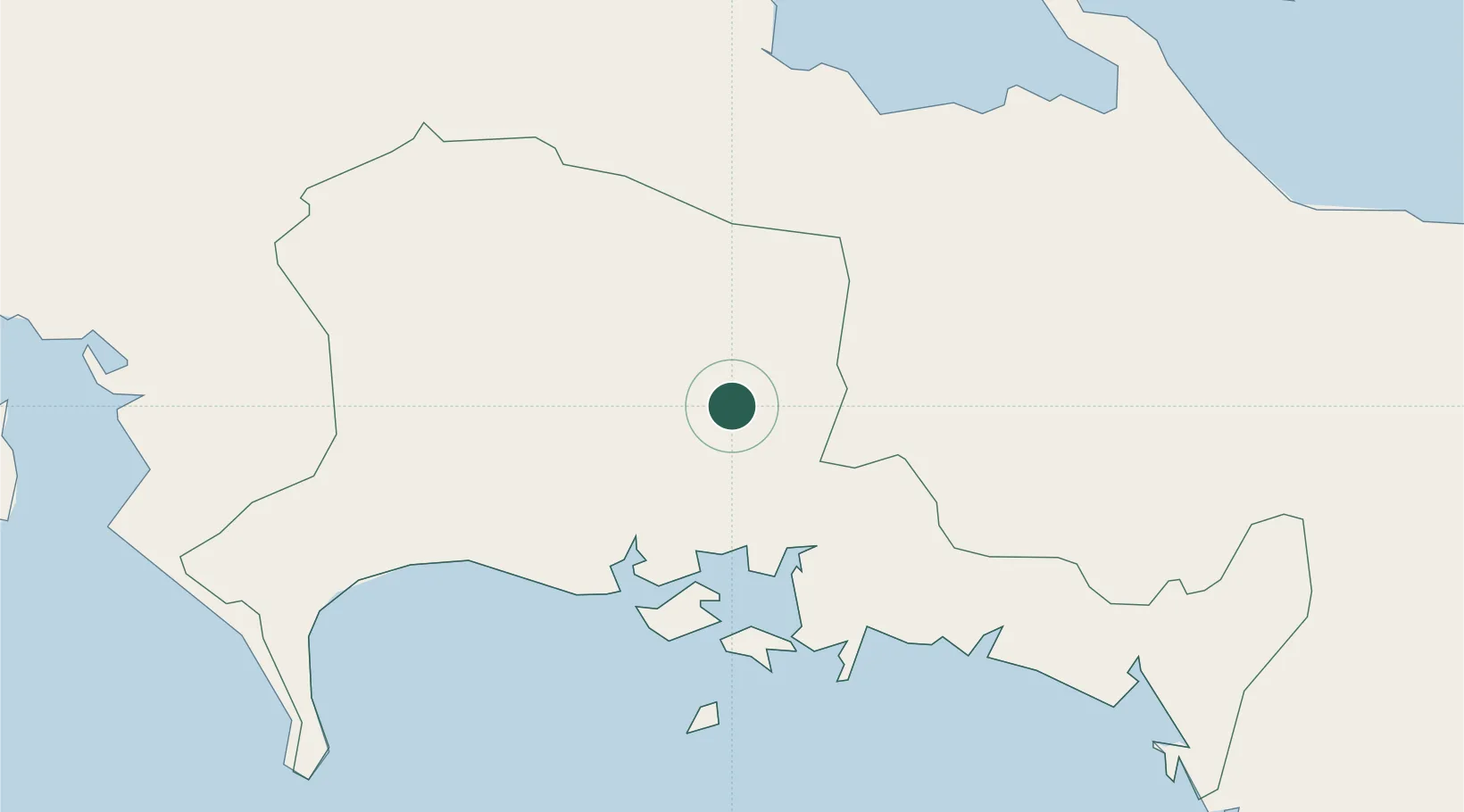
Nearby Logistics Neighbours

Cities
  1. 1Pedregal24 km
  2. 2Bugaba35 km
  3. 3Boca Chica36 km
  4. 4Chiriquí Grande51 km
  5. 5Progreso59 km
Nearest neighbours — logibook spatial index (haversine) over the source coordinates
Ports
  1. 1Pedregal25 km
  2. 2Chiriqui Grande51 km
  3. 3Puerto Armuelles67 km
  4. 4Charco Azul72 km
  5. 5Almirante86 km
Nearest neighbours — logibook spatial index (haversine) over the source coordinates
Airports
  1. 1Enrique Malek International Airport22 km
  2. 2Coto 47 Airport74 km
  3. 3Bocas del Toro "Isla Colón" International Airport90 km
  4. 4Golfito Airport98 km
  5. 5Changuinola Captain Manuel Niño International Airport106 km
Nearest neighbours — logibook spatial index (haversine) over the source coordinates
Trade Zones
  1. 1Baru Free Zone (Tourist and Multimodal Logistics Support Zone)68 km
  2. 2Caribe Industrial Park & Free Zone185 km
  3. 3Zona Franca Cobol Due211 km
  4. 4FreeHold Free Zone217 km
  5. 5Zeta Free Zone Catargo233 km
Nearest neighbours — logibook spatial index (haversine) over the source coordinates
DatabookThe Record of Consolidated Knowledge
Panama beyond logistics?
Browse databook

All Sources

LocationsUN/LOCODE
UN/LOCODE — free
LocationsGeoNames
CC BY 4.0
Portsthe NGA World Port Index
Public domain (US gov)
AirportsOurAirports
Public domain
Trade Zonesthe World Bank SEZ database
CC BY 4.0
Trade ZonesOpen Zone Map
CC BY
← Panama locations