Export Processing Zone · Costa Rica

FreeHold Free Zone Under Development
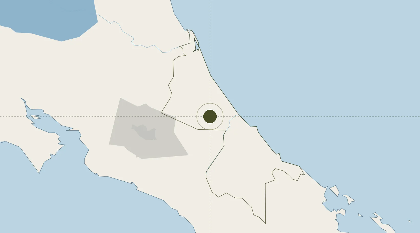
10.1013°, -83.4725°
58 ha
Zone area
44.1 km
Nearest port
37.8 km
Nearest airport

Gateway access

Nearest neighbours — logibook spatial index (haversine) over the source coordinates

Zone profile

Zone type
Export Processing Zone
Open Zone Map
Region
Limón
Open Zone Map
Status
Under Development
Open Zone Map
Management
Private
Open Zone Map
Operator
Freehold Free Zone S.A
Open Zone Map
Legal framework
Free Zone Regime Act No 7210, Act No 8794 and its Bylaws
Open Zone Map

Location

Location of ozm-1693
Natural Earth 10m (public domain) · Limón · ozm-1693 · 10.10, -83.47GoogleOSMYandex

Nearby Logistics Neighbours

Ports
  1. 1Puerto Moin44 km
  2. 2Puerto Limon52 km
  3. 3Puerto Quepos106 km
  4. 4Puerto Caldera138 km
  5. 5Almirante148 km
Nearest neighbours — logibook spatial index (haversine) over the source coordinates
Airports
  1. 1Guapiles Airport38 km
  2. 2Aerotortuguero Airport39 km
  3. 3Limón International Airport52 km
  4. 4Tobías Bolaños International Airport75 km
  5. 5Barra del Colorado Airport75 km
Nearest neighbours — logibook spatial index (haversine) over the source coordinates
Cities
  1. 1Siquirres5 km
  2. 2Francia9 km
  3. 3Limon Via Turrialba17 km
  4. 4Playa Hermosa22 km
  5. 5Rio Jimenez22 km
Nearest neighbours — logibook spatial index (haversine) over the source coordinates
Trade Zones
  1. 1Caribe Industrial Park & Free Zone42 km
  2. 2Lima Free Zone and Business Park59 km
  3. 3Zeta Free Zone Catargo59 km
  4. 4El Roble Industrial Logistics Zone (RILZ)67 km
  5. 5Parque Empresarial Del Este68 km
Nearest neighbours — logibook spatial index (haversine) over the source coordinates
DatabookThe Record of Consolidated Knowledge
Costa Rica beyond logistics?
Browse databook

All Sources

Trade ZonesOpen Zone Map
CC BY
Portsthe NGA World Port Index
Public domain (US gov)
AirportsOurAirports
Public domain
LocationsUN/LOCODE
UN/LOCODE — free
← Costa Rica trade zones