Seaport · New Zealand
NapierNZNPE
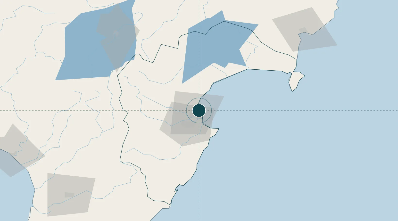
-39.4833°, 176.9167°
11.0 m
Channel depth
1
Container terminals
88.3
Port liner connectivity
Channel & Berth Profile
Pilotage, Tugs & Services
Pilotage compulsoryYES
Pilotage availableYES
Pilotage advisableYES
Tug assistanceYES
Shore powerYES
Potable waterYES
MedicalYES
Garbage disposalYES
Facilities & Capabilities
Container—
Ro-Ro—
Liquid bulk—
Dry bulk—
Oil terminal—
Break bulk—
Dry dock—
RepairsNO
BunkeringYES
Rail linkYES
Dangerous cargo—
ISPS security—
Harbour Specifications
Harbour size
Small
Harbour type
Coastal (Breakwater)
Shelter
Fair
Water body
South Pacific Ocean
Tidal range
1 m
Overhead limit
Yes
Pilotage
Yes
Liner Connectivity
88.3
PLSCI
Port Liner Shipping Connectivity Index for Napier, as published by UNCTAD for the latest available quarter. Higher values indicate stronger scheduled liner-shipping integration.
Shown relative to the highest per-port PLSCI in the dataset (1,657.9).
Location
Container Terminals · 1
NAPIER PORT
NPENZ PORT OF NAPIER LTD.
Nearby Logistics Neighbours
Ports
- 1Gisborne132 km
- 2Wanganui169 km
- 3Tauranga216 km
- 4New Plymouth253 km
- 5Wellington270 km
Cities
- 1Seaview2 km
- 2Dannevirke107 km
- 3Waiouru107 km
- 4Gisborne131 km
- 5Longburn154 km
Airports
- 1Hawke's Bay Airport5 km
- 2Wairoa Airport67 km
- 3Taupo Airport110 km
- 4Gisborne Airport129 km
- 5Palmerston North Airport145 km
Trade Zones
- 1Hicks Bay Area Special Economic Zone235 km
- 2Rotuma-Kadavu Tax-Free Region2377 km
- 3Kalabu Tax Free Zone2384 km
- 4Nausori-Ba Tax-Free Region2391 km
- 5Lautoka Special Zone2432 km
DatabookThe Record of Consolidated Knowledge
New Zealand beyond logistics?