UN/LOCODE hub · United States
USTOV

Ottoville

40.9333°, -84.3333°
971
Population
2
Transport functions

Transport Functions

Road
Multimodal
UN/LOCODE

Hub Profile

Place type
Populated place
GeoNames
Region
Ohio
GeoNames
Population
971
GeoNames
Time zone
America/New_York
GeoNames
Elevation
225 m
GeoNames

Location

Location of USTOV
Natural Earth 10m (public domain) · Ohio · USTOV · 40.93, -84.33GoogleOSMYandex

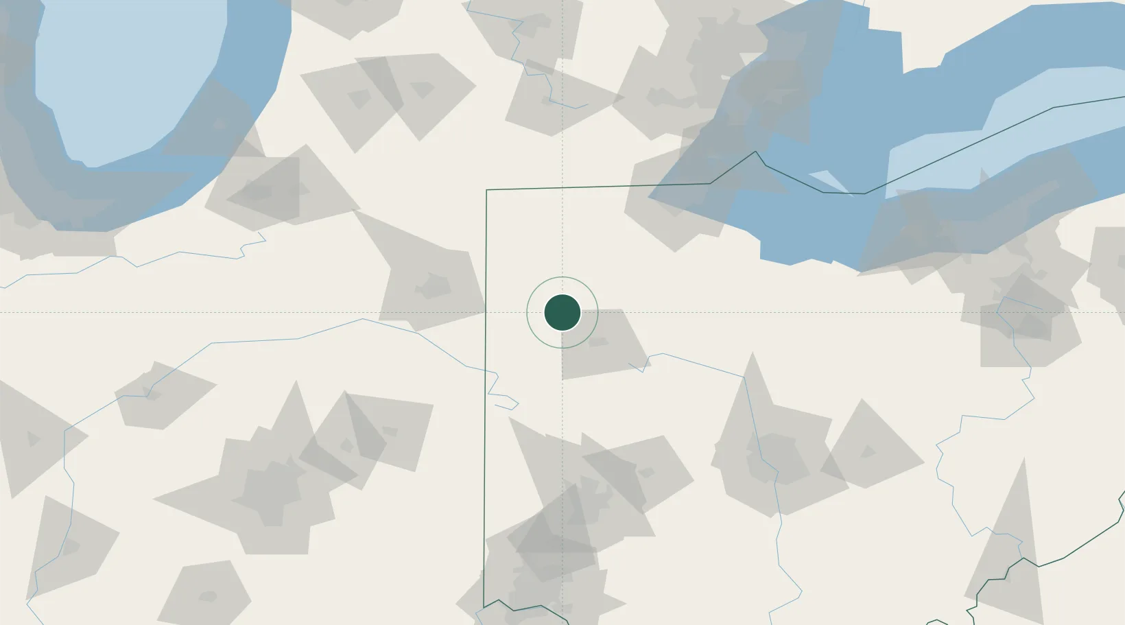
Nearby Logistics Neighbours

Cities
  1. 1Rimer13 km
  2. 2Oakwood, Paulding17 km
  3. 3Columbus Grove23 km
  4. 4Haviland23 km
  5. 5Spencerville26 km
Nearest neighbours — logibook spatial index (haversine) over the source coordinates
Ports
  1. 1Toledo112 km
  2. 2Port Clinton134 km
  3. 3Monroe135 km
  4. 4Sandusky147 km
  5. 5Put In Bay150 km
Nearest neighbours — logibook spatial index (haversine) over the source coordinates
Airports
  1. 1Findlay Airport57 km
  2. 2Fort Wayne International Airport73 km
  3. 3Eugene F. Kranz Toledo Express Airport85 km
  4. 4James M. Cox Dayton International Airport115 km
  5. 5Delaware County Johnson Field118 km
Nearest neighbours — logibook spatial index (haversine) over the source coordinates
Trade Zones
  1. 1FTZ No. 151 Findlay54 km
  2. 2FTZ No. 182 Fort Wayne82 km
  3. 3FTZ No. 008 Toledo105 km
  4. 4FTZ No. 100 Dayton126 km
  5. 5FTZ No. 138 Franklin County172 km
Nearest neighbours — logibook spatial index (haversine) over the source coordinates
DatabookThe Record of Consolidated Knowledge
United States beyond logistics?
Browse databook

All Sources

LocationsUN/LOCODE
UN/LOCODE — free
LocationsGeoNames
CC BY 4.0
Portsthe NGA World Port Index
Public domain (US gov)
AirportsOurAirports
Public domain
Trade Zonesthe World Bank SEZ database
CC BY 4.0
Trade ZonesOpen Zone Map
CC BY
← United States locations