UN/LOCODE hub · Norway
NOFND

Finneid

67.2500°, 15.4167°
1
Transport functions

Transport Functions

Port
UN/LOCODE

Hub Profile

Place type
Populated place
GeoNames
Region
Nordland
GeoNames
Time zone
Europe/Oslo
GeoNames

Location

Location of NOFND
Natural Earth 10m (public domain) · Nordland · NOFND · 67.25, 15.42GoogleOSMYandex

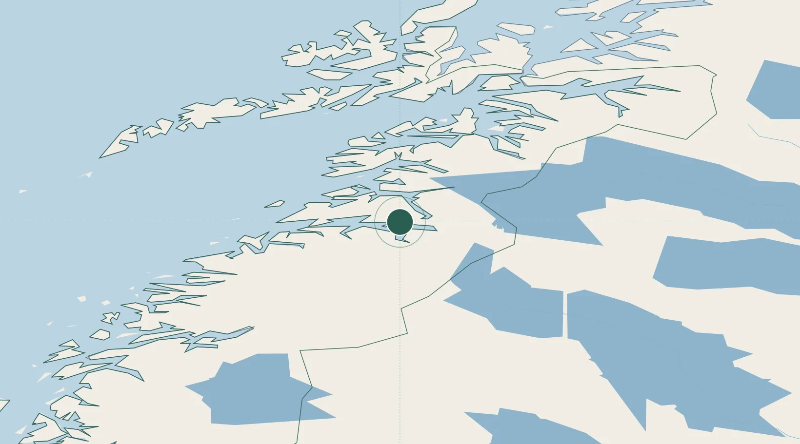
Nearby Logistics Neighbours

Cities
  1. 1Fauske1 km
  2. 2Sørfold13 km
  3. 3Salten15 km
  4. 4Rognan17 km
  5. 5Hammerfall17 km
Nearest neighbours — logibook spatial index (haversine) over the source coordinates
Ports
  1. 1Fauske1 km
  2. 2Lakselv14 km
  3. 3Rognan16 km
  4. 4Kjerringoy41 km
  5. 5Bodo45 km
Nearest neighbours — logibook spatial index (haversine) over the source coordinates
Airports
  1. 1Bodø Airport45 km
  2. 2Mo i Rana Airport, Røssvoll110 km
  3. 3Svolvær Airport, Helle115 km
  4. 4Værøy Heliport123 km
  5. 5Leknes Airport126 km
Nearest neighbours — logibook spatial index (haversine) over the source coordinates
Trade Zones
  1. 1Oulu Port Free Warehouse Area514 km
  2. 2Turku Free Zone826 km
  3. 3Stockholm Free Zone889 km
  4. 4Freeport of Hanko903 km
  5. 5Port of Hamina-Kotka939 km
Nearest neighbours — logibook spatial index (haversine) over the source coordinates
DatabookThe Record of Consolidated Knowledge
Norway beyond logistics?
Browse databook

All Sources

LocationsUN/LOCODE
UN/LOCODE — free
Portsthe NGA World Port Index
Public domain (US gov)
AirportsOurAirports
Public domain
Trade Zonesthe World Bank SEZ database
CC BY 4.0
Trade ZonesOpen Zone Map
CC BY
← Norway locations