UN/LOCODE hub · India
INPPT

Paradip Port

20.2500°, 86.5833°
1
Transport functions

Transport Functions

Port
Paradip Port is also a profiled seaport →
UN/LOCODE

Hub Profile

Region
OR
GeoNames

Location

Location of INPPT
Natural Earth 10m (public domain) · OR · INPPT · 20.25, 86.58GoogleOSMYandex

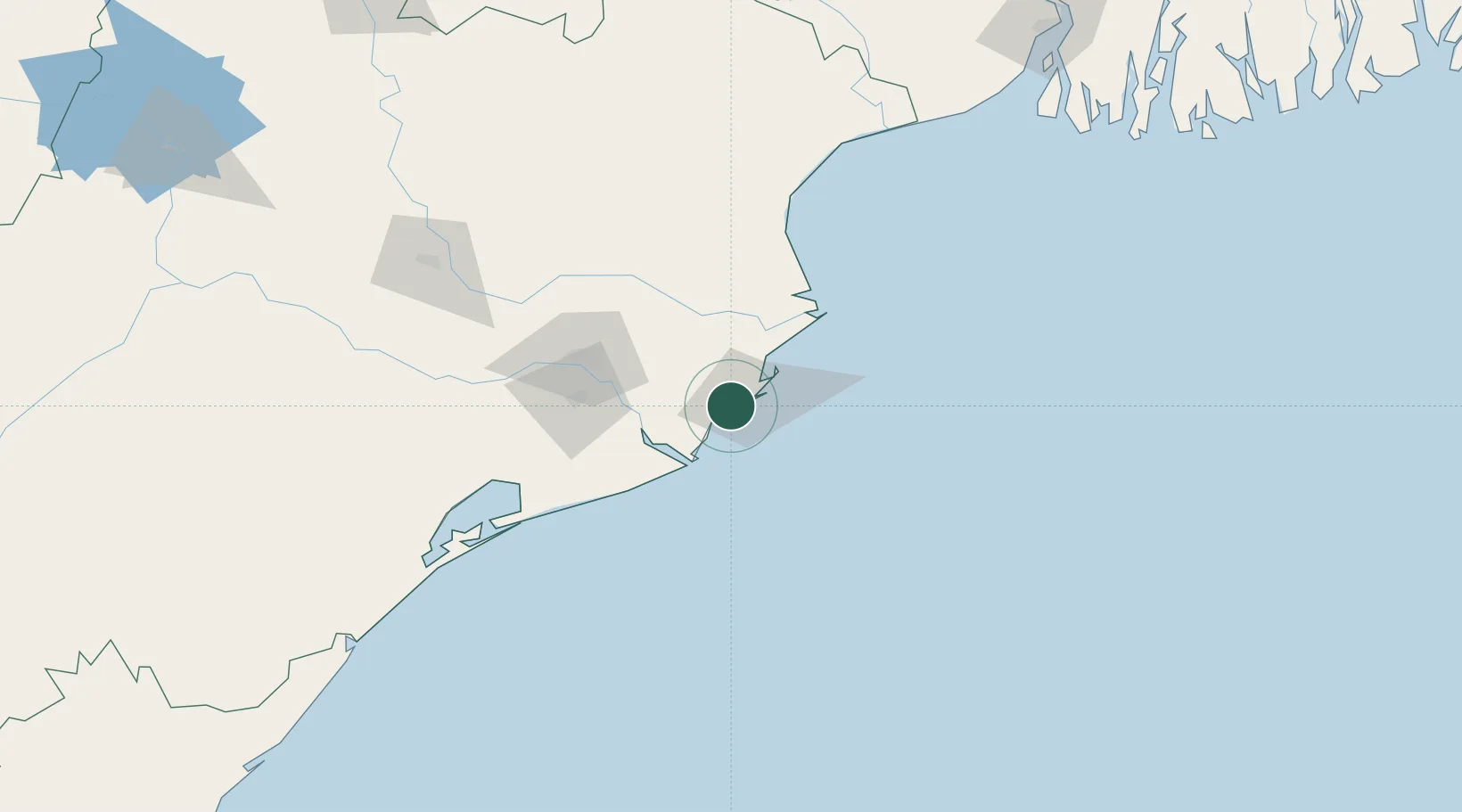
Nearby Logistics Neighbours

Cities
  1. 1Paradip Garh9 km
  2. 2Dhamara70 km
  3. 3Dhamra Port74 km
  4. 4ICD JSL/JAJPUR97 km
  5. 5Concor ICD/Balasore141 km
Nearest neighbours — logibook spatial index (haversine) over the source coordinates
Ports
  1. 1Dhamra75 km
  2. 2Gopalpur199 km
  3. 3Haldia Port251 km
  4. 4Calcutta313 km
  5. 5Mongla398 km
Nearest neighbours — logibook spatial index (haversine) over the source coordinates
Airports
  1. 1Biju Patnaik International Airport80 km
  2. 2Sonari Airport288 km
  3. 3Rourkela Airport289 km
  4. 4Jharsuguda Airport321 km
  5. 5Netaji Subhash Chandra Bose International Airport330 km
Nearest neighbours — logibook spatial index (haversine) over the source coordinates
Trade Zones
  1. 1Orissa Industrial Development Corporation78 km
  2. 2Hindalco Industries Limited80 km
  3. 3Saraf Agencies private Limited199 km
  4. 4Falta Special Economic Zone275 km
  5. 5Adityapur Industrial area development authority285 km
Nearest neighbours — logibook spatial index (haversine) over the source coordinates
DatabookThe Record of Consolidated Knowledge
India beyond logistics?
Browse databook

All Sources

LocationsUN/LOCODE
UN/LOCODE — free
Portsthe NGA World Port Index
Public domain (US gov)
AirportsOurAirports
Public domain
Trade Zonesthe World Bank SEZ database
CC BY 4.0
Trade ZonesOpen Zone Map
CC BY
← India locations