UN/LOCODE hub · India
INBLE

Concor ICD/Balasore

21.4833°, 86.9167°
1
Transport functions

Transport Functions

Multimodal
UN/LOCODE

Hub Profile

Region
OR
GeoNames

Location

Location of INBLE
Natural Earth 10m (public domain) · OR · INBLE · 21.48, 86.92GoogleOSMYandex

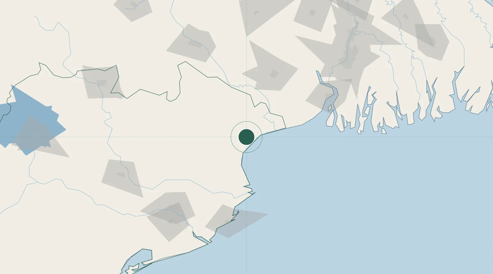
Nearby Logistics Neighbours

Cities
  1. 1Dhamra Port74 km
  2. 2Dhamara76 km
  3. 3Kharagpur104 km
  4. 4ICD JSL/JAJPUR106 km
  5. 5Paradip Garh138 km
Nearest neighbours — logibook spatial index (haversine) over the source coordinates
Ports
  1. 1Dhamra74 km
  2. 2Haldia Port134 km
  3. 3Paradip137 km
  4. 4Calcutta188 km
  5. 5Mongla298 km
Nearest neighbours — logibook spatial index (haversine) over the source coordinates
Airports
  1. 1Sonari Airport167 km
  2. 2Biju Patnaik International Airport179 km
  3. 3Netaji Subhash Chandra Bose International Airport205 km
  4. 4Panagarh Air Force Station228 km
  5. 5Rourkela Airport233 km
Nearest neighbours — logibook spatial index (haversine) over the source coordinates
Trade Zones
  1. 1Falta Special Economic Zone150 km
  2. 2Adityapur Industrial area development authority164 km
  3. 3Orissa Industrial Development Corporation174 km
  4. 4Hindalco Industries Limited174 km
  5. 5M.L. Dalmiya and Company Limited190 km
Nearest neighbours — logibook spatial index (haversine) over the source coordinates
DatabookThe Record of Consolidated Knowledge
India beyond logistics?
Browse databook

All Sources

LocationsUN/LOCODE
UN/LOCODE — free
Portsthe NGA World Port Index
Public domain (US gov)
AirportsOurAirports
Public domain
Trade Zonesthe World Bank SEZ database
CC BY 4.0
Trade ZonesOpen Zone Map
CC BY
← India locations