UN/LOCODE hub · India
INDMA

Dhamara

20.8000°, 86.9000°
3
Transport functions

Transport Functions

Port
Rail
Road
UN/LOCODE

Hub Profile

Place type
Populated place
GeoNames
Region
Odisha
GeoNames
Time zone
Asia/Kolkata
GeoNames
Elevation
6 m
GeoNames

Location

Location of INDMA
Natural Earth 10m (public domain) · Odisha · INDMA · 20.80, 86.90GoogleOSMYandex

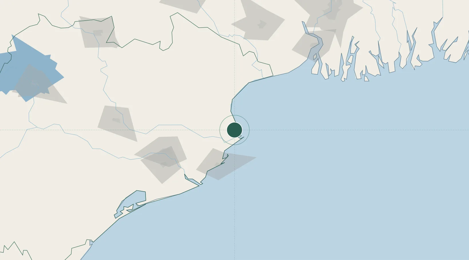
Nearby Logistics Neighbours

Cities
  1. 1Dhamra Port6 km
  2. 2Paradip Garh65 km
  3. 3Paradip Port70 km
  4. 4Concor ICD/Balasore76 km
  5. 5ICD JSL/JAJPUR90 km
Nearest neighbours — logibook spatial index (haversine) over the source coordinates
Ports
  1. 1Dhamra7 km
  2. 2Paradip64 km
  3. 3Haldia Port183 km
  4. 4Calcutta245 km
  5. 5Gopalpur262 km
Nearest neighbours — logibook spatial index (haversine) over the source coordinates
Airports
  1. 1Biju Patnaik International Airport128 km
  2. 2Sonari Airport236 km
  3. 3Netaji Subhash Chandra Bose International Airport261 km
  4. 4Rourkela Airport270 km
  5. 5Panagarh Air Force Station302 km
Nearest neighbours — logibook spatial index (haversine) over the source coordinates
Trade Zones
  1. 1Orissa Industrial Development Corporation124 km
  2. 2Hindalco Industries Limited125 km
  3. 3Falta Special Economic Zone206 km
  4. 4Adityapur Industrial area development authority234 km
  5. 5M.L. Dalmiya and Company Limited246 km
Nearest neighbours — logibook spatial index (haversine) over the source coordinates
DatabookThe Record of Consolidated Knowledge
India beyond logistics?
Browse databook

All Sources

LocationsUN/LOCODE
UN/LOCODE — free
Portsthe NGA World Port Index
Public domain (US gov)
AirportsOurAirports
Public domain
Trade Zonesthe World Bank SEZ database
CC BY 4.0
Trade ZonesOpen Zone Map
CC BY
← India locations