Specialized Zone · India

Hindalco Industries Limited Active
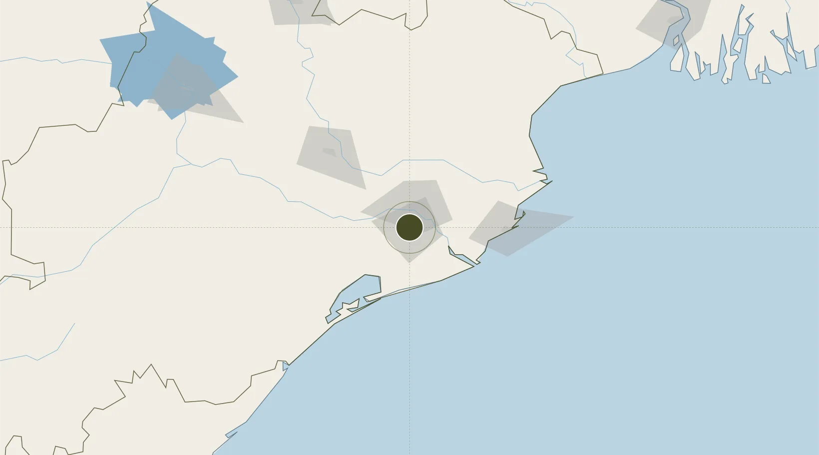
20.2988°, 85.8213°
116 ha
Zone area
90.0 km
Nearest port
5.4 km
Nearest airport

Gateway access

Nearest neighbours — logibook spatial index (haversine) over the source coordinates

Zone profile

Zone type
Specialized Zone
Open Zone Map
Specialization
Mining
Open Zone Map
Region
Odisha
Open Zone Map
Status
Active
Open Zone Map
Management
Private
Open Zone Map
Operator
Hindalco Industries, Aditya Birla Group
Open Zone Map
Legal framework
Odisha Policy for Special Economic Zones - 2015
Open Zone Map

Location

Location of ozm-2300
Natural Earth 10m (public domain) · Odisha · ozm-2300 · 20.30, 85.82GoogleOSMYandex

Nearby Logistics Neighbours

Ports
  1. 1Paradip90 km
  2. 2Dhamra132 km
  3. 3Gopalpur142 km
  4. 4Haldia Port303 km
  5. 5Calcutta361 km
Nearest neighbours — logibook spatial index (haversine) over the source coordinates
Airports
  1. 1Biju Patnaik International Airport5 km
  2. 2Rourkela Airport241 km
  3. 3Jharsuguda Airport257 km
  4. 4Utkela Airport276 km
  5. 5Sonari Airport282 km
Nearest neighbours — logibook spatial index (haversine) over the source coordinates
Cities
  1. 1ICD JSL/JAJPUR78 km
  2. 2Paradip Port80 km
  3. 3Paradip Garh88 km
  4. 4Dhamara125 km
  5. 5Tata Steel SEZ/Ganjam129 km
Nearest neighbours — logibook spatial index (haversine) over the source coordinates
Trade Zones
  1. 1Orissa Industrial Development Corporation2 km
  2. 2Saraf Agencies private Limited141 km
  3. 3Vedanta Aluminium Limited261 km
  4. 4Adityapur Industrial area development authority279 km
  5. 5Falta Special Economic Zone322 km
Nearest neighbours — logibook spatial index (haversine) over the source coordinates
DatabookThe Record of Consolidated Knowledge
India beyond logistics?
Browse databook

All Sources

Trade ZonesOpen Zone Map
CC BY
Portsthe NGA World Port Index
Public domain (US gov)
AirportsOurAirports
Public domain
LocationsUN/LOCODE
UN/LOCODE — free
← India trade zones