UN/LOCODE hub · India
INDMQ

Dhamra Port

20.8167°, 86.9500°
1
Transport functions

Transport Functions

Port
Dhamra Port is also a profiled seaport →
UN/LOCODE

Hub Profile

Region
OR
GeoNames

Location

Location of INDMQ
Natural Earth 10m (public domain) · OR · INDMQ · 20.82, 86.95GoogleOSMYandex

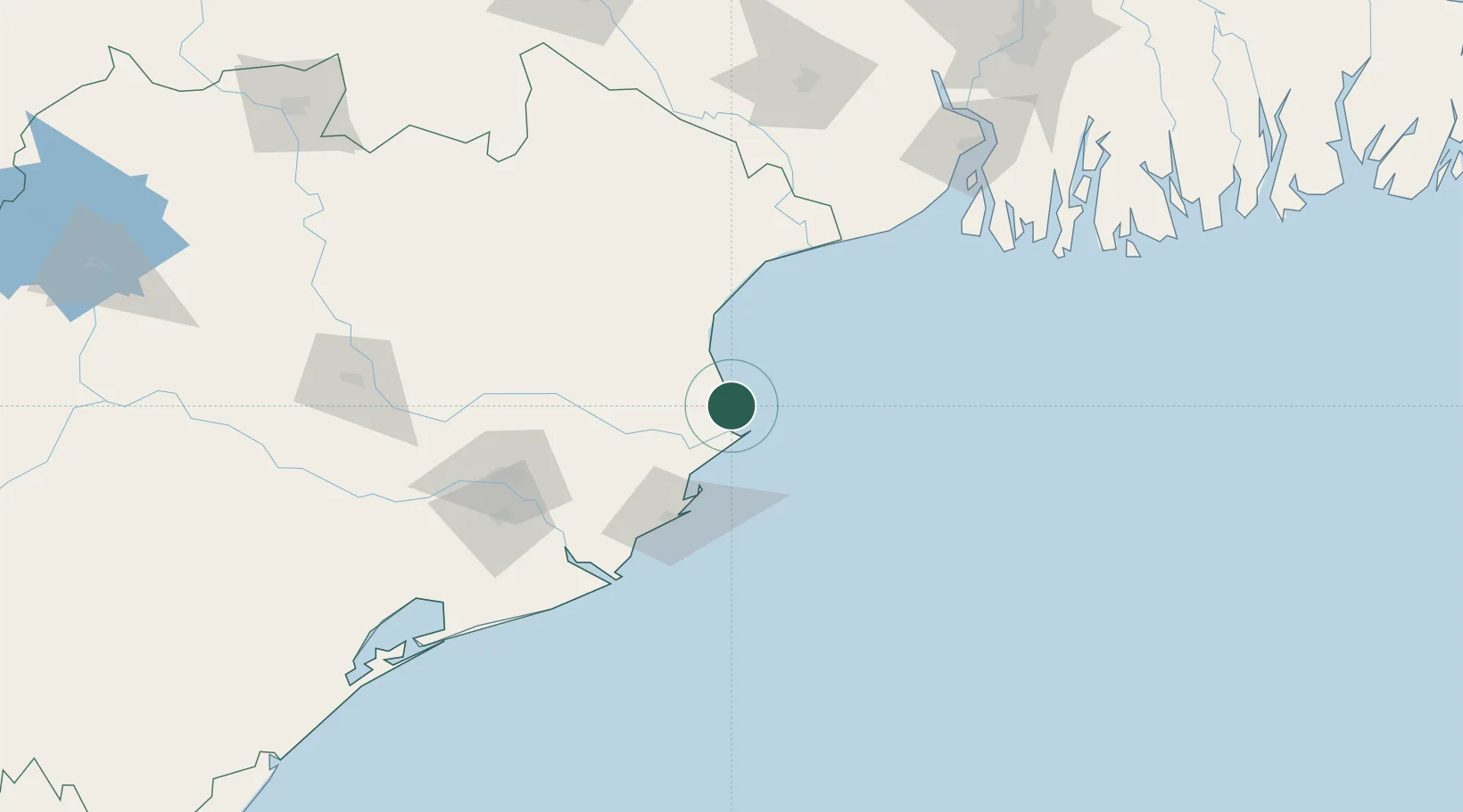
Nearby Logistics Neighbours

Cities
  1. 1Dhamara6 km
  2. 2Paradip Garh69 km
  3. 3Paradip Port74 km
  4. 4Concor ICD/Balasore74 km
  5. 5ICD JSL/JAJPUR94 km
Nearest neighbours — logibook spatial index (haversine) over the source coordinates
Ports
  1. 1Paradip67 km
  2. 2Haldia Port178 km
  3. 3Calcutta240 km
  4. 4Gopalpur267 km
  5. 5Mongla330 km
Nearest neighbours — logibook spatial index (haversine) over the source coordinates
Airports
  1. 1Biju Patnaik International Airport134 km
  2. 2Sonari Airport236 km
  3. 3Netaji Subhash Chandra Bose International Airport256 km
  4. 4Rourkela Airport273 km
  5. 5Panagarh Air Force Station300 km
Nearest neighbours — logibook spatial index (haversine) over the source coordinates
Trade Zones
  1. 1Orissa Industrial Development Corporation130 km
  2. 2Hindalco Industries Limited131 km
  3. 3Falta Special Economic Zone201 km
  4. 4Adityapur Industrial area development authority234 km
  5. 5M.L. Dalmiya and Company Limited241 km
Nearest neighbours — logibook spatial index (haversine) over the source coordinates
DatabookThe Record of Consolidated Knowledge
India beyond logistics?
Browse databook

All Sources

LocationsUN/LOCODE
UN/LOCODE — free
Portsthe NGA World Port Index
Public domain (US gov)
AirportsOurAirports
Public domain
Trade Zonesthe World Bank SEZ database
CC BY 4.0
Trade ZonesOpen Zone Map
CC BY
← India locations