UN/LOCODE hub · Indonesia
IDPWI

Purwosari

-7.7667°, 112.7333°
1
Transport functions

Transport Functions

Multimodal
UN/LOCODE

Hub Profile

Place type
Populated place
GeoNames
Region
East Java
GeoNames
Time zone
Asia/Jakarta
GeoNames
Elevation
255 m
GeoNames

Location

Location of IDPWI
Natural Earth 10m (public domain) · East Java · IDPWI · -7.77, 112.73GoogleOSMYandex

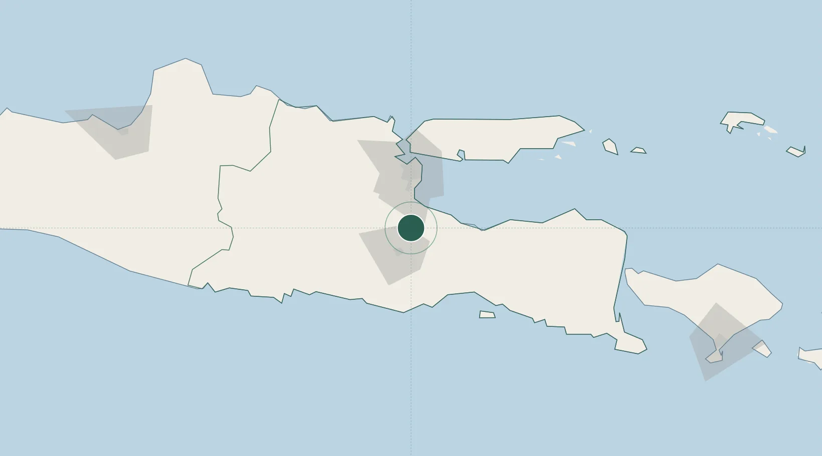
Nearby Logistics Neighbours

Cities
  1. 1Pasuruan, Java24 km
  2. 2Jawa Timur26 km
  3. 3Mojosari34 km
  4. 4Mojokerto47 km
  5. 5Surabaya60 km
Nearest neighbours — logibook spatial index (haversine) over the source coordinates
Ports
  1. 1Probolinggo54 km
  2. 2Surabaya63 km
  3. 3Gresik69 km
  4. 4Poleng Oil Field126 km
  5. 5Tuban132 km
Nearest neighbours — logibook spatial index (haversine) over the source coordinates
Airports
  1. 1Abdul Rachman Saleh Airport18 km
  2. 2Juanda International Airport43 km
  3. 3Dhoho International Airport87 km
  4. 4Notohadinegoro Airport118 km
  5. 5Banyuwangi Airport187 km
Nearest neighbours — logibook spatial index (haversine) over the source coordinates
Trade Zones
  1. 1KEK Singhasari17 km
  2. 2Pasuruan Industrial Estate Rembang21 km
  3. 3Ngoro Industrial Park26 km
  4. 4Safe N Lock Industrial Estate34 km
  5. 5Surabaya Industrial Estate - Rungkut49 km
Nearest neighbours — logibook spatial index (haversine) over the source coordinates
DatabookThe Record of Consolidated Knowledge
Indonesia beyond logistics?
Browse databook

All Sources

LocationsUN/LOCODE
UN/LOCODE — free
Portsthe NGA World Port Index
Public domain (US gov)
AirportsOurAirports
Public domain
Trade Zonesthe World Bank SEZ database
CC BY 4.0
Trade ZonesOpen Zone Map
CC BY
← Indonesia locations