UN/LOCODE hub · United Kingdom
GBACE

Achiltibuie

58.0333°, -5.3667°
1
Transport functions

Transport Functions

Port
UN/LOCODE

Hub Profile

Place type
Populated place
GeoNames
Region
Scotland
GeoNames
Time zone
Europe/London
GeoNames
Elevation
27 m
GeoNames

Location

Location of GBACE
Natural Earth 10m (public domain) · Scotland · GBACE · 58.03, -5.37GoogleOSMYandex

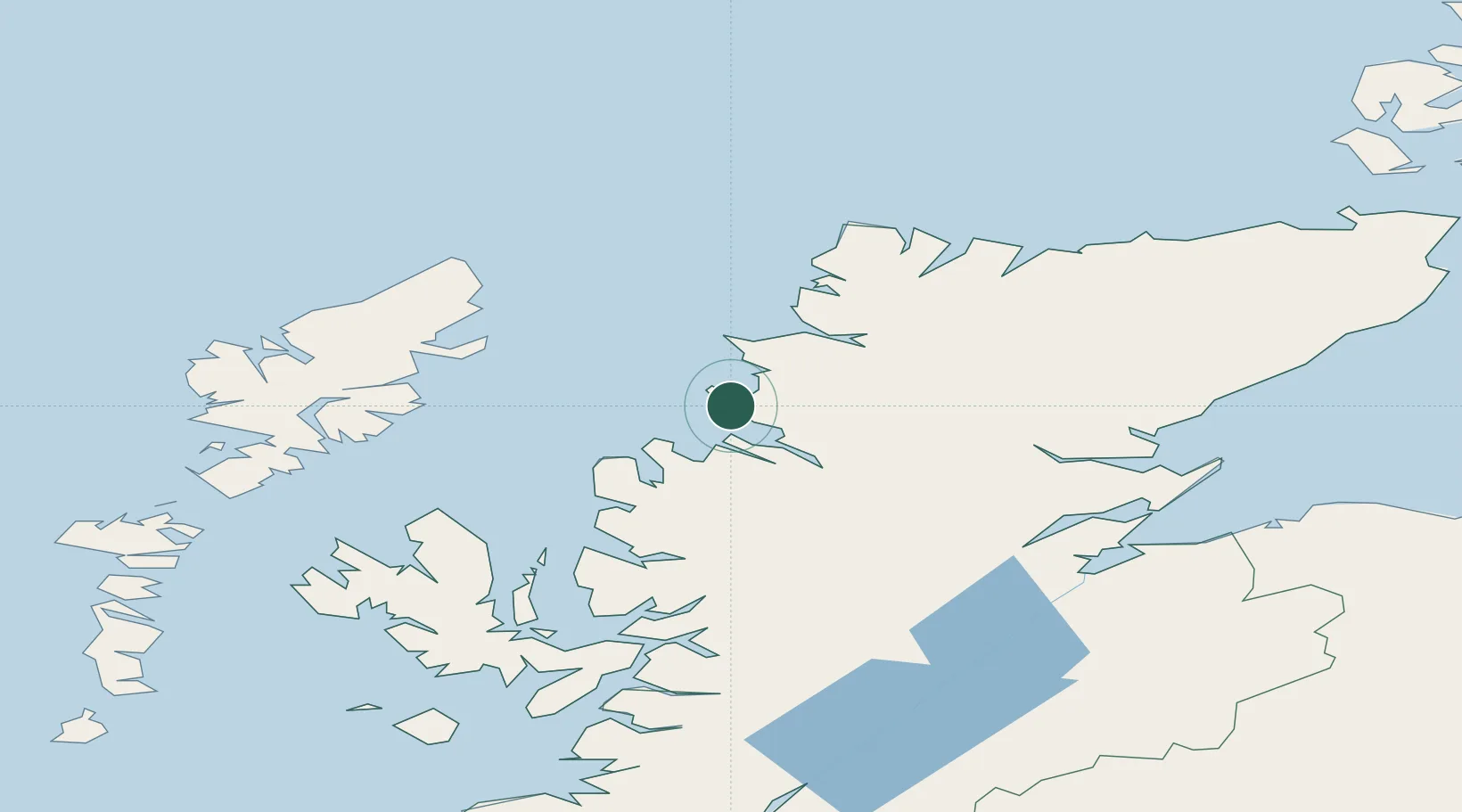
Nearby Logistics Neighbours

Cities
  1. 1Old Dornie3 km
  2. 2Lochinver15 km
  3. 3Rhu Coigach - Badluachrach17 km
  4. 4Ullapool19 km
  5. 5Culkein/Drumbeg22 km
Nearest neighbours — logibook spatial index (haversine) over the source coordinates
Ports
  1. 1Ullapool20 km
  2. 2Aultbea26 km
  3. 3Gairloch40 km
  4. 4Stornoway Harbor61 km
  5. 5Uig77 km
Nearest neighbours — logibook spatial index (haversine) over the source coordinates
Airports
  1. 1Stornoway Airport60 km
  2. 2Inverness Airport95 km
  3. 3RAF Lossiemouth125 km
  4. 4Benbecula Airport133 km
  5. 5Wick John O'Groats Airport141 km
Nearest neighbours — logibook spatial index (haversine) over the source coordinates
Trade Zones
  1. 1Prestwick Airport Free Zone284 km
  2. 2Carlisle Kingmoor Park Enterprise Zone375 km
  3. 3North Eastern Enterprise Zone411 km
  4. 4Isle of Man Free Zone and Business Park441 km
  5. 5Tees Valley Enterprise Zone460 km
Nearest neighbours — logibook spatial index (haversine) over the source coordinates
DatabookThe Record of Consolidated Knowledge
United Kingdom beyond logistics?
Browse databook

All Sources

LocationsUN/LOCODE
UN/LOCODE — free
Portsthe NGA World Port Index
Public domain (US gov)
AirportsOurAirports
Public domain
Trade Zonesthe World Bank SEZ database
CC BY 4.0
Trade ZonesOpen Zone Map
CC BY
← United Kingdom locations