Economic Revitalization Project · United Kingdom

North Eastern Enterprise Zone Active
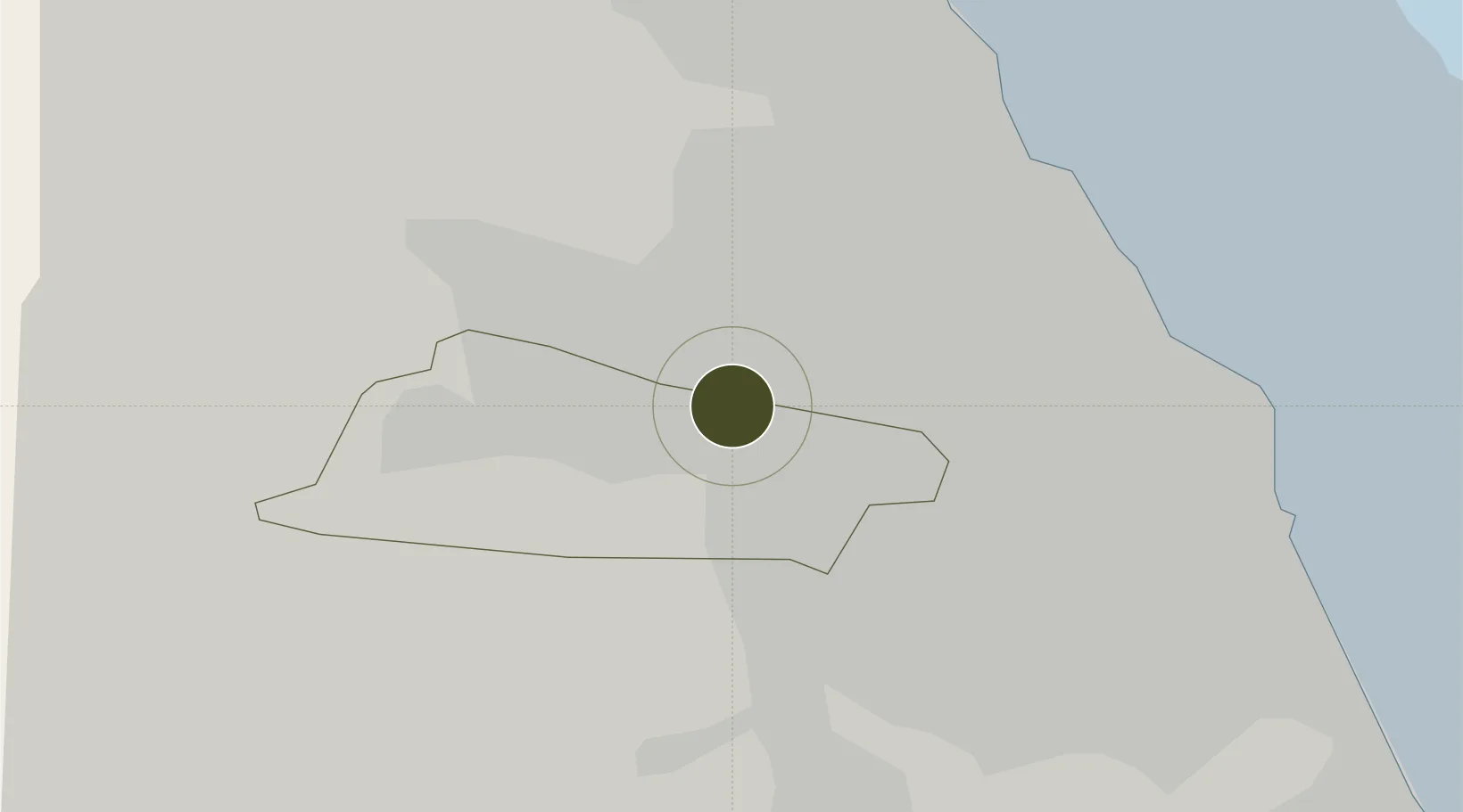
54.9664°, -1.6226°
175 ha
Zone area
14.7 km
Nearest port
9.0 km
Nearest airport

Gateway access

Nearest neighbours — logibook spatial index (haversine) over the source coordinates

Zone profile

Zone type
Economic Revitalization Project
Open Zone Map
Region
Gateshead
Open Zone Map
Status
Active
Open Zone Map
Management
Public-Private Partnership
Open Zone Map
Operator
North Eastern Local Enterprise Partnership
Open Zone Map
Legal framework
Local Government, Planning and Land Act 1980
Open Zone Map

Location

Location of ozm-4703
Natural Earth 10m (public domain) · Gateshead · ozm-4703 · 54.97, -1.62GoogleOSMYandex

Nearby Logistics Neighbours

Ports
  1. 1Tynemouth15 km
  2. 2Sunderland17 km
  3. 3Blyth18 km
  4. 4Seaham25 km
  5. 5Hartlepool41 km
Nearest neighbours — logibook spatial index (haversine) over the source coordinates
Airports
  1. 1Newcastle International Airport9 km
  2. 2Teesside International Airport52 km
  3. 3RAF Spadeadam60 km
  4. 4RAF Leeming75 km
  5. 5Carlisle Lake District Airport76 km
Nearest neighbours — logibook spatial index (haversine) over the source coordinates
Cities
  1. 1Newcastle upon Tyne1 km
  2. 2Dunston3 km
  3. 3Team Valley/Gateshead3 km
  4. 4Gateshead4 km
  5. 5Walker5 km
Nearest neighbours — logibook spatial index (haversine) over the source coordinates
Trade Zones
  1. 1Tees Valley Enterprise Zone49 km
  2. 2Carlisle Kingmoor Park Enterprise Zone86 km
  3. 3York Central Enterprise Zone117 km
  4. 4Aire Valley Leeds Enterprise Zone132 km
  5. 5Lancashire Enterprise Zone152 km
Nearest neighbours — logibook spatial index (haversine) over the source coordinates
DatabookThe Record of Consolidated Knowledge
United Kingdom beyond logistics?
Browse databook

All Sources

Trade ZonesOpen Zone Map
CC BY
Portsthe NGA World Port Index
Public domain (US gov)
AirportsOurAirports
Public domain
LocationsUN/LOCODE
UN/LOCODE — free
← United Kingdom trade zones