UN/LOCODE hub · Egypt
EGPSE

Port Said East

31.2167°, 32.3500°
4
Transport functions

Transport Functions

Port
Rail
Road
Multimodal
UN/LOCODE

Hub Profile

Region
SUZ
GeoNames

Location

Location of EGPSE
Natural Earth 10m (public domain) · SUZ · EGPSE · 31.22, 32.35GoogleOSMYandex

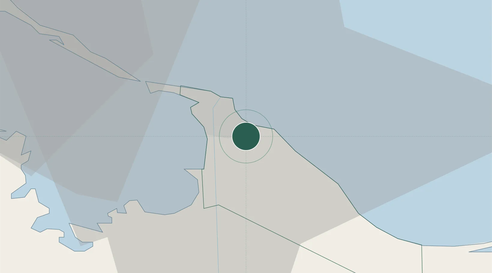
Nearby Logistics Neighbours

Cities
  1. 1Port Said2 km
  2. 2Marsa Egyptian Propylene & Polypropylene21 km
  3. 3Dumyat (Damietta)62 km
  4. 4Al Mansurah96 km
  5. 5Samannud110 km
Nearest neighbours — logibook spatial index (haversine) over the source coordinates
Ports
  1. 1Bur Sa'id7 km
  2. 2Damietta64 km
  3. 3El Ismailiya71 km
  4. 4As Suways140 km
  5. 5Al Arish141 km
Nearest neighbours — logibook spatial index (haversine) over the source coordinates
Airports
  1. 1Port Said International Airport13 km
  2. 2Ismailia Air Base70 km
  3. 3Abu Suwayr Air Base76 km
  4. 4Al Mansurah Airbase92 km
  5. 5Bilbeis 2 Airfield109 km
Nearest neighbours — logibook spatial index (haversine) over the source coordinates
Trade Zones
  1. 1Port Said Public Free Zone6 km
  2. 2Damietta Public Free Zone61 km
  3. 3Ishmailia Public Free Zone70 km
  4. 4Mit Ghamr Investment Zone118 km
  5. 510th of Ramadan Free Zone120 km
Nearest neighbours — logibook spatial index (haversine) over the source coordinates
DatabookThe Record of Consolidated Knowledge
Egypt beyond logistics?
Browse databook

All Sources

LocationsUN/LOCODE
UN/LOCODE — free
Portsthe NGA World Port Index
Public domain (US gov)
AirportsOurAirports
Public domain
Trade Zonesthe World Bank SEZ database
CC BY 4.0
Trade ZonesOpen Zone Map
CC BY
← Egypt locations