UN/LOCODE hub · Australia
AUMOE

Moe

-38.1667°, 146.2667°
9,375
Population
2
Transport functions

Transport Functions

Rail
Road
UN/LOCODE

Hub Profile

Place type
Populated place
GeoNames
Region
Victoria
GeoNames
Population
9,375
GeoNames
Time zone
Australia/Melbourne
GeoNames
Elevation
76 m
GeoNames

Location

Location of AUMOE
Natural Earth 10m (public domain) · Victoria · AUMOE · -38.17, 146.27GoogleOSMYandex

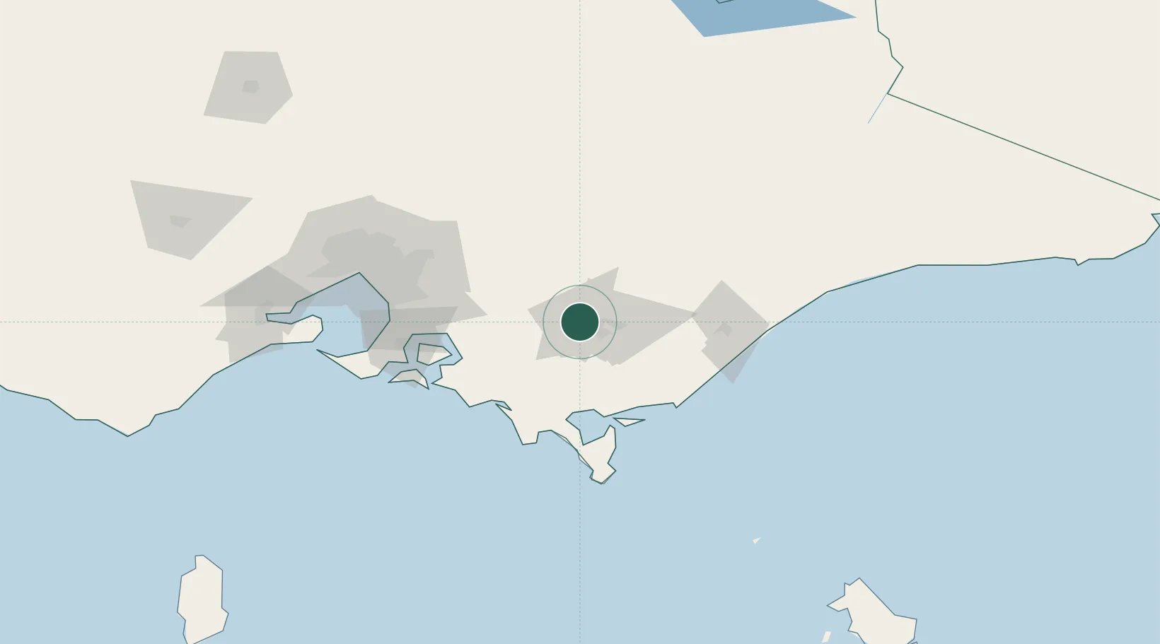
Nearby Logistics Neighbours

Cities
  1. 1Warragul29 km
  2. 2Berrys Creek33 km
  3. 3Flynn36 km
  4. 4Drouin37 km
  5. 5Ashwood41 km
Nearest neighbours — logibook spatial index (haversine) over the source coordinates
Ports
  1. 1Welshpool62 km
  2. 2Western Port93 km
  3. 3Melbourne120 km
  4. 4Geelong166 km
  5. 5Stanley301 km
Nearest neighbours — logibook spatial index (haversine) over the source coordinates
Airports
  1. 1Latrobe Valley Airport19 km
  2. 2West Sale Airport62 km
  3. 3RAAF Base East Sale78 km
  4. 4Melbourne Moorabbin Airport104 km
  5. 5Bairnsdale Airport118 km
Nearest neighbours — logibook spatial index (haversine) over the source coordinates
Trade Zones
  1. 1Latrobe Valley Economic Growth Zone13 km
  2. 2Hicks Bay Area Special Economic Zone2784 km
  3. 3Paga Hill Estate Special Economic Zone3191 km
  4. 4Vanuatu Economic Development Zone3246 km
  5. 5Ihu Special Economic Zone3367 km
Nearest neighbours — logibook spatial index (haversine) over the source coordinates
DatabookThe Record of Consolidated Knowledge
Australia beyond logistics?
Browse databook

All Sources

LocationsUN/LOCODE
UN/LOCODE — free
LocationsGeoNames
CC BY 4.0
Portsthe NGA World Port Index
Public domain (US gov)
AirportsOurAirports
Public domain
Trade Zonesthe World Bank SEZ database
CC BY 4.0
Trade ZonesOpen Zone Map
CC BY
← Australia locations