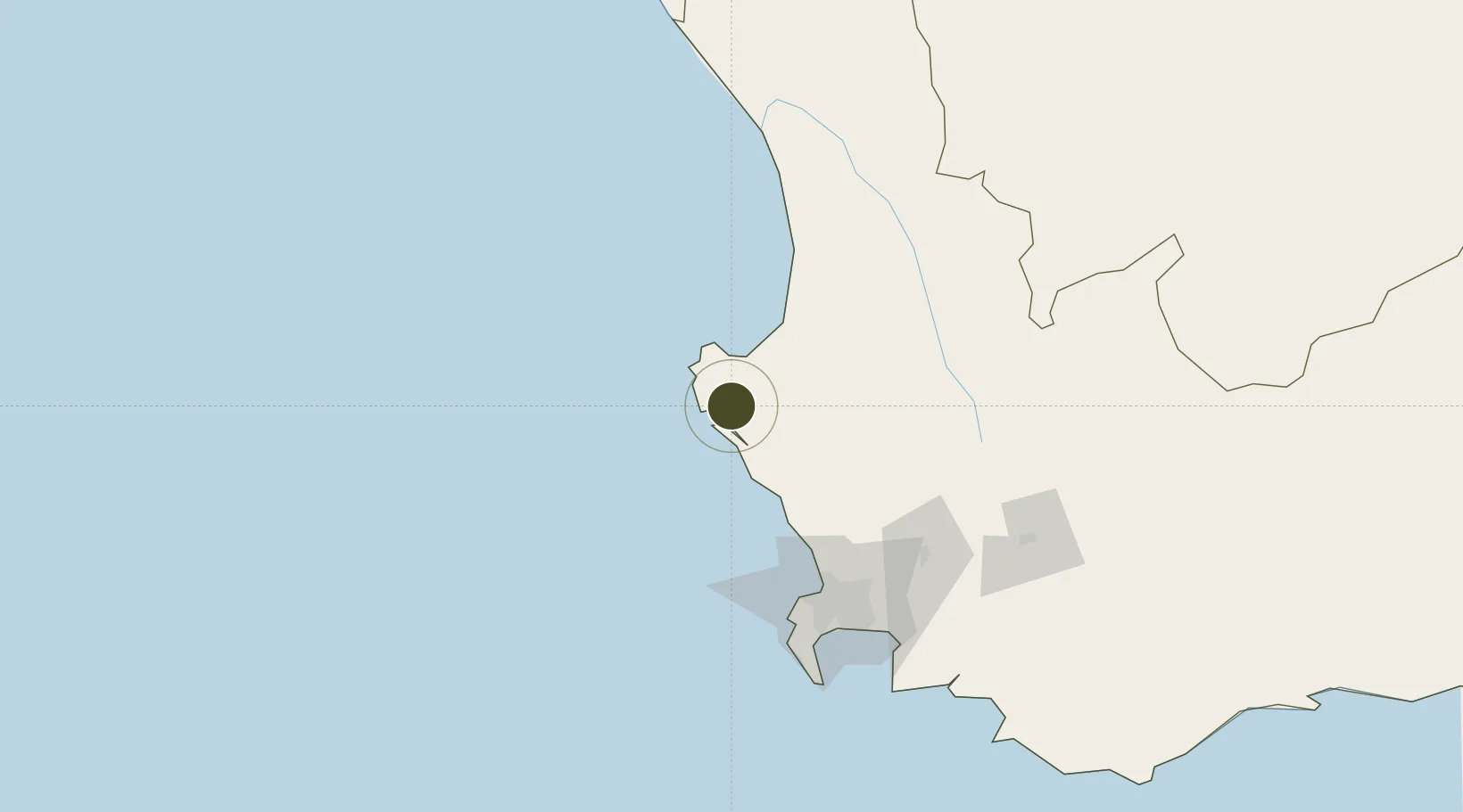
Diversified Zone · South Africa

Saldanha Bay Special Economic Zone Active

-33.0088°, 18.0487°
356 ha
Zone area
8.1 km
Nearest port
8.9 km
Nearest airport

Gateway access

Nearest neighbours — logibook spatial index (haversine) over the source coordinates

Zone profile

Zone type
Diversified Zone
Open Zone Map
Region
Western Cape
Open Zone Map
Status
Active
Open Zone Map
Management
Public-Private Partnership
Open Zone Map
Operator
Saldanha Bay IDZ Licencing Company SOC Ltd
Open Zone Map
Legal framework
Saldanha Bay Industrial Development Zone Licensing Company Act
Open Zone Map

Location

Location of ozm-4146
Natural Earth 10m (public domain) · Western Cape · ozm-4146 · -33.01, 18.05GoogleOSMYandex

Nearby Logistics Neighbours

Ports
  1. 1Saldanha Bay8 km
  2. 2Cape Town107 km
  3. 3Simonstown136 km
  4. 4Mossel Bay401 km
  5. 5Port Elizabeth712 km
Nearest neighbours — logibook spatial index (haversine) over the source coordinates
Airports
  1. 1Saldanha/Vredenburg Airport9 km
  2. 2Langebaanweg Airport11 km
  3. 3Ysterplaat Air Force Base108 km
  4. 4Cape Town International Airport119 km
  5. 5Vredendal Airport159 km
Nearest neighbours — logibook spatial index (haversine) over the source coordinates
Cities
  1. 1Bottelary15 km
  2. 2Laaiplek29 km
  3. 3Piketberg65 km
  4. 4Dassenberg75 km
  5. 5Malmesbury80 km
Nearest neighbours — logibook spatial index (haversine) over the source coordinates
Trade Zones
  1. 1Atlantis Special Economic Zone76 km
  2. 2Namakwa (Nama-Khoi) Special Economic Zone430 km
  3. 3Upington Special Economic Zone593 km
  4. 4Somerset East Industrial Park705 km
  5. 5Coega Industrial Development Zone713 km
Nearest neighbours — logibook spatial index (haversine) over the source coordinates
DatabookThe Record of Consolidated Knowledge
South Africa beyond logistics?
Browse databook

All Sources

Trade ZonesOpen Zone Map
CC BY
Portsthe NGA World Port Index
Public domain (US gov)
AirportsOurAirports
Public domain
LocationsUN/LOCODE
UN/LOCODE — free
← South Africa trade zones