UN/LOCODE hub · South Africa
ZADSS

Dassenberg

-33.5333°, 18.5500°
2
Transport functions

Transport Functions

Road
Multimodal
UN/LOCODE

Hub Profile

Region
WC
GeoNames

Location

Location of ZADSS
Natural Earth 10m (public domain) · WC · ZADSS · -33.53, 18.55GoogleOSMYandex

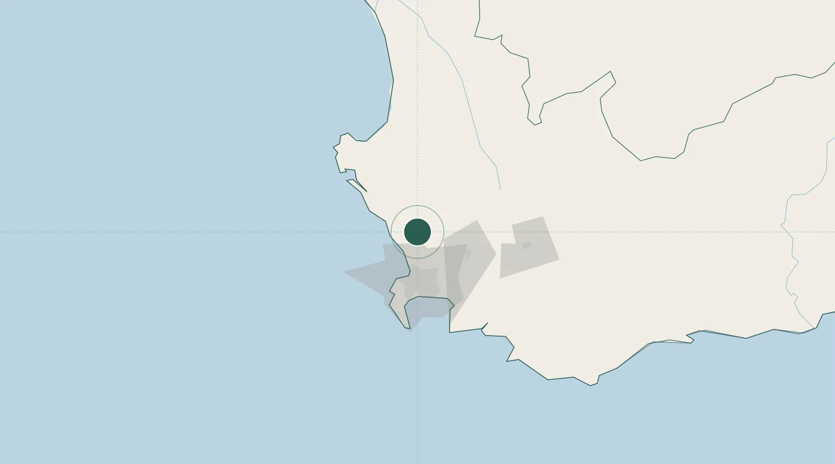
Nearby Logistics Neighbours

Cities
  1. 1Philidelphia13 km
  2. 2Malmesbury19 km
  3. 3Klipheuwel23 km
  4. 4Melkbosstrand25 km
  5. 5Bloubergstrand31 km
Nearest neighbours — logibook spatial index (haversine) over the source coordinates
Ports
  1. 1Cape Town44 km
  2. 2Simonstown73 km
  3. 3Saldanha Bay78 km
  4. 4Mossel Bay340 km
  5. 5Port Elizabeth657 km
Nearest neighbours — logibook spatial index (haversine) over the source coordinates
Airports
  1. 1Ysterplaat Air Force Base41 km
  2. 2Cape Town International Airport49 km
  3. 3Langebaanweg Airport73 km
  4. 4Saldanha/Vredenburg Airport83 km
  5. 5Robertson Airport129 km
Nearest neighbours — logibook spatial index (haversine) over the source coordinates
Trade Zones
  1. 1Atlantis Special Economic Zone9 km
  2. 2Saldanha Bay Special Economic Zone75 km
  3. 3Namakwa (Nama-Khoi) Special Economic Zone481 km
  4. 4Upington Special Economic Zone622 km
  5. 5Coega Industrial Development Zone660 km
Nearest neighbours — logibook spatial index (haversine) over the source coordinates
DatabookThe Record of Consolidated Knowledge
South Africa beyond logistics?
Browse databook

All Sources

LocationsUN/LOCODE
UN/LOCODE — free
Portsthe NGA World Port Index
Public domain (US gov)
AirportsOurAirports
Public domain
Trade Zonesthe World Bank SEZ database
CC BY 4.0
Trade ZonesOpen Zone Map
CC BY
← South Africa locations