Seaport · United States

Drift RiverUSDRF

60.5500°, -152.1333°

Channel & Berth Profile

SEA LEVEL (CD)CHANNEL BEDOil terminal · 17.1 m
NGA World Port Index

Pilotage, Tugs & Services

Pilotage availableYES
NGA World Port Index

Facilities & Capabilities

Container
Ro-Ro
Liquid bulk
Dry bulk
Oil terminal
Break bulk
Dry dock
Repairs
Bunkering
Rail link
Dangerous cargo
ISPS security
NGA World Port Index

Harbour Specifications

Harbour size
Very Small
NGA World Port Index
Harbour type
Coastal (Natural)
NGA World Port Index
Shelter
Fair
NGA World Port Index
Water body
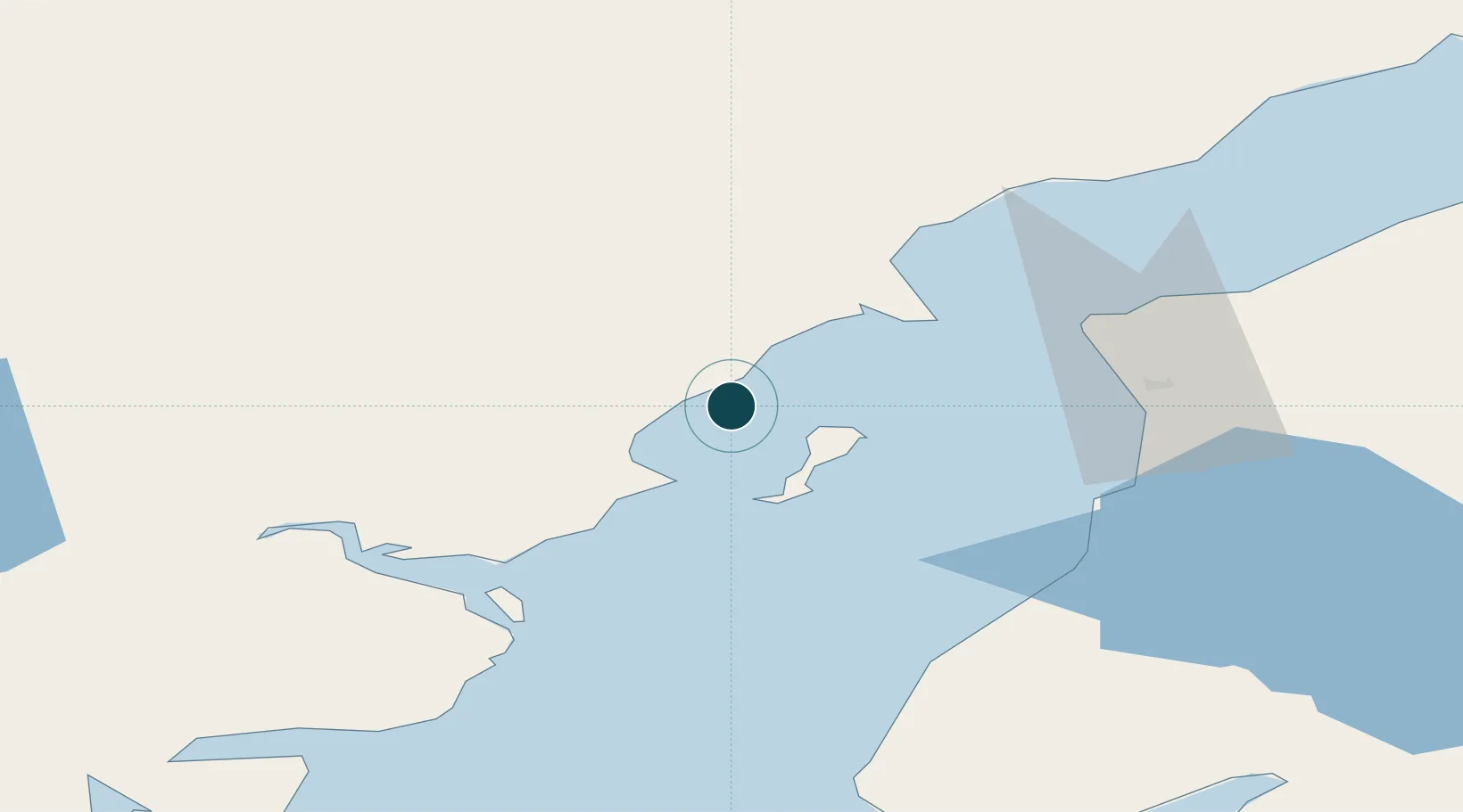
Cook Inlet; Gulf of Alaska; North Pacific Ocean
NGA World Port Index

Location

Location of USDRF
Natural Earth 10m (public domain) · Alaska · USDRF · 60.55, -152.13GoogleOSMYandex

Nearby Logistics Neighbours

Ports
  1. 1Nikiski43 km
  2. 2Kenai47 km
  3. 3Ninilchik61 km
  4. 4Homer113 km
  5. 5Seldovia126 km
Nearest neighbours — logibook spatial index (haversine) over the source coordinates
Cities
  1. 1Jakolof Bay127 km
  2. 2Susitna140 km
  3. 3Anchorage144 km
  4. 4Port MacKenzie144 km
  5. 5Elmendorf Air Force Base148 km
Nearest neighbours — logibook spatial index (haversine) over the source coordinates
Airports
  1. 1Kenai Municipal Airport49 km
  2. 2Soldotna Airport61 km
  3. 3Homer Airport107 km
  4. 4Seldovia Airport125 km
  5. 5Port Alsworth Airport127 km
Nearest neighbours — logibook spatial index (haversine) over the source coordinates
Trade Zones
  1. 1FTZ No. 160 Anchorage144 km
  2. 2FTZ No. 108 Valdez319 km
  3. 3FTZ No. 232 Kodiak353 km
  4. 4FTZ No. 195 Fairbanks528 km
  5. 5PrInce George Logistics Park1896 km
Nearest neighbours — logibook spatial index (haversine) over the source coordinates
DatabookThe Record of Consolidated Knowledge
United States beyond logistics?
Browse databook

All Sources

Portsthe NGA World Port Index
Public domain (US gov)
AirportsOurAirports
Public domain
LocationsUN/LOCODE
UN/LOCODE — free
Trade Zonesthe World Bank SEZ database
CC BY 4.0
Trade ZonesOpen Zone Map
CC BY
← United States ports