Seaport · United States

CarpinteriaUSCPT

34.3833°, -119.5167°

Channel & Berth Profile

SEA LEVEL (CD)CHANNEL BEDOil terminal · 15.5 m
NGA World Port Index

Facilities & Capabilities

Container
Ro-Ro
Liquid bulk
Dry bulk
Oil terminal
Break bulk
Dry dock
Repairs
Bunkering
Rail link
Dangerous cargo
ISPS security
NGA World Port Index

Harbour Specifications

Harbour size
Very Small
NGA World Port Index
Harbour type
Coastal (Natural)
NGA World Port Index
Shelter
Poor
NGA World Port Index
Water body
North Pacific Ocean
NGA World Port Index
Tidal range
1.2 m
NGA World Port Index

Location

Location of USCPT
Natural Earth 10m (public domain) · California · USCPT · 34.38, -119.52GoogleOSMYandex

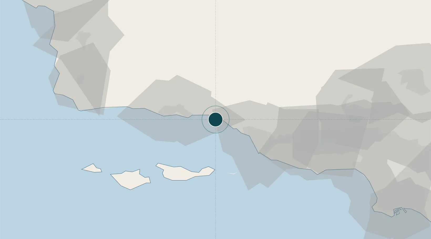
Nearby Logistics Neighbours

Ports
  1. 1Santa Barbara16 km
  2. 2Ventura24 km
  3. 3Ellwood37 km
  4. 4Port Hueneme39 km
  5. 5El Segundo112 km
Nearest neighbours — logibook spatial index (haversine) over the source coordinates
Cities
  1. 1Summerland9 km
  2. 2Ojai27 km
  3. 3Goleta30 km
  4. 4Ventura33 km
  5. 5Ellwood34 km
Nearest neighbours — logibook spatial index (haversine) over the source coordinates
Airports
  1. 1Santa Barbara Municipal Airport30 km
  2. 2Oxnard Airport35 km
  3. 3Camarillo International Airport43 km
  4. 4Point Mugu Naval Air Station (Naval Base Ventura Co)47 km
  5. 5Van Nuys Airport96 km
Nearest neighbours — logibook spatial index (haversine) over the source coordinates
Trade Zones
  1. 1FTZ No. 205 Port Hueneme39 km
  2. 2FTZ No. 276 Kern County119 km
  3. 3FTZ No. 191 Palmdale130 km
  4. 4FTZ No. 202 Los Angeles134 km
  5. 5FTZ No. 050 Long Beach142 km
Nearest neighbours — logibook spatial index (haversine) over the source coordinates
DatabookThe Record of Consolidated Knowledge
United States beyond logistics?
Browse databook

All Sources

Portsthe NGA World Port Index
Public domain (US gov)
AirportsOurAirports
Public domain
LocationsUN/LOCODE
UN/LOCODE — free
Trade Zonesthe World Bank SEZ database
CC BY 4.0
Trade ZonesOpen Zone Map
CC BY
← United States ports