Seaport · Indonesia

WahaiIDWBA

-2.7833°, 129.5000°
23.2 m
Channel depth

Channel & Berth Profile

SEA LEVEL (CD)CHANNEL BEDCargo pier · 3.4 mChannel · 23.2 mAnchorage · 23.2 m
NGA World Port Index

Facilities & Capabilities

Container
Ro-Ro
Liquid bulk
Dry bulk
Oil terminal
Break bulk
Dry dock
Repairs
Bunkering
Rail link
Dangerous cargo
ISPS security
NGA World Port Index

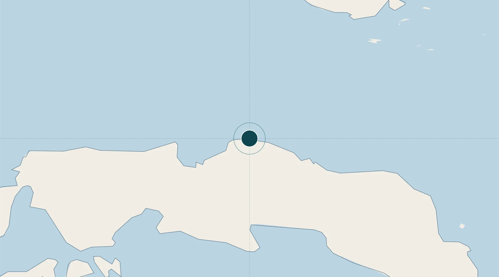
Harbour Specifications

Harbour size
Very Small
NGA World Port Index
Harbour type
Coastal (Natural)
NGA World Port Index
Shelter
Fair
NGA World Port Index
Water body
Ceram Sea; Banda Sea; South Pacific Ocean
NGA World Port Index
Tidal range
2 m
NGA World Port Index

Location

Location of IDWBA
Natural Earth 10m (public domain) · Maluku · IDWBA · -2.78, 129.50GoogleOSMYandex

Nearby Logistics Neighbours

Ports
  1. 1Bula117 km
  2. 2Ambon179 km
  3. 3Salawati229 km
  4. 4Kasim Terminal236 km
  5. 5Namlea274 km
Nearest neighbours — logibook spatial index (haversine) over the source coordinates
Cities
  1. 1Piru150 km
  2. 2Loki171 km
  3. 3Misool Terminal176 km
  4. 4Angar177 km
  5. 5Ambon, Molucas178 km
Nearest neighbours — logibook spatial index (haversine) over the source coordinates
Airports
  1. 1Pattimura International Airport188 km
  2. 2Namniwel Airport283 km
  3. 3Domine Eduard Osok Airport289 km
  4. 4Marinda Airport298 km
  5. 5Fakfak Airport308 km
Nearest neighbours — logibook spatial index (haversine) over the source coordinates
Trade Zones
  1. 1KEK Sorong275 km
  2. 2KEK Morotai560 km
  3. 3Bitung Special Economic Zone675 km
  4. 4KEK Likupang693 km
  5. 5Atauro Special Economic Zone743 km
Nearest neighbours — logibook spatial index (haversine) over the source coordinates
DatabookThe Record of Consolidated Knowledge
Indonesia beyond logistics?
Browse databook

All Sources

Portsthe NGA World Port Index
Public domain (US gov)
AirportsOurAirports
Public domain
LocationsUN/LOCODE
UN/LOCODE — free
Trade Zonesthe World Bank SEZ database
CC BY 4.0
Trade ZonesOpen Zone Map
CC BY
← Indonesia ports