Seaport · Indonesia

PanarukanIDPRN

-7.7000°, 113.9333°

Channel & Berth Profile

SEA LEVEL (CD)CHANNEL BEDAnchorage · 15.5 mOil terminal · 23.2 m
NGA World Port Index

Pilotage, Tugs & Services

Pilotage compulsoryNO
Pilotage availableNO
Pilotage advisableYES
Tug assistanceYES
Salvage tugsYES
Diesel bunkersNO
MedicalYES
NGA World Port Index

Facilities & Capabilities

Container
Ro-Ro
Liquid bulk
Dry bulk
Oil terminal
Break bulk
Dry dock
Repairs
BunkeringNO
Rail linkYES
Dangerous cargo
ISPS security
NGA World Port Index

Harbour Specifications

Harbour size
Very Small
NGA World Port Index
Harbour type
Coastal (Natural)
NGA World Port Index
Water body
Bali Sea; Java Sea; South Pacific Ocean
NGA World Port Index
Pilotage
No
NGA World Port Index

Location

Location of IDPRN
Natural Earth 10m (public domain) · Jawa Timur · IDPRN · -7.70, 113.93GoogleOSMYandex

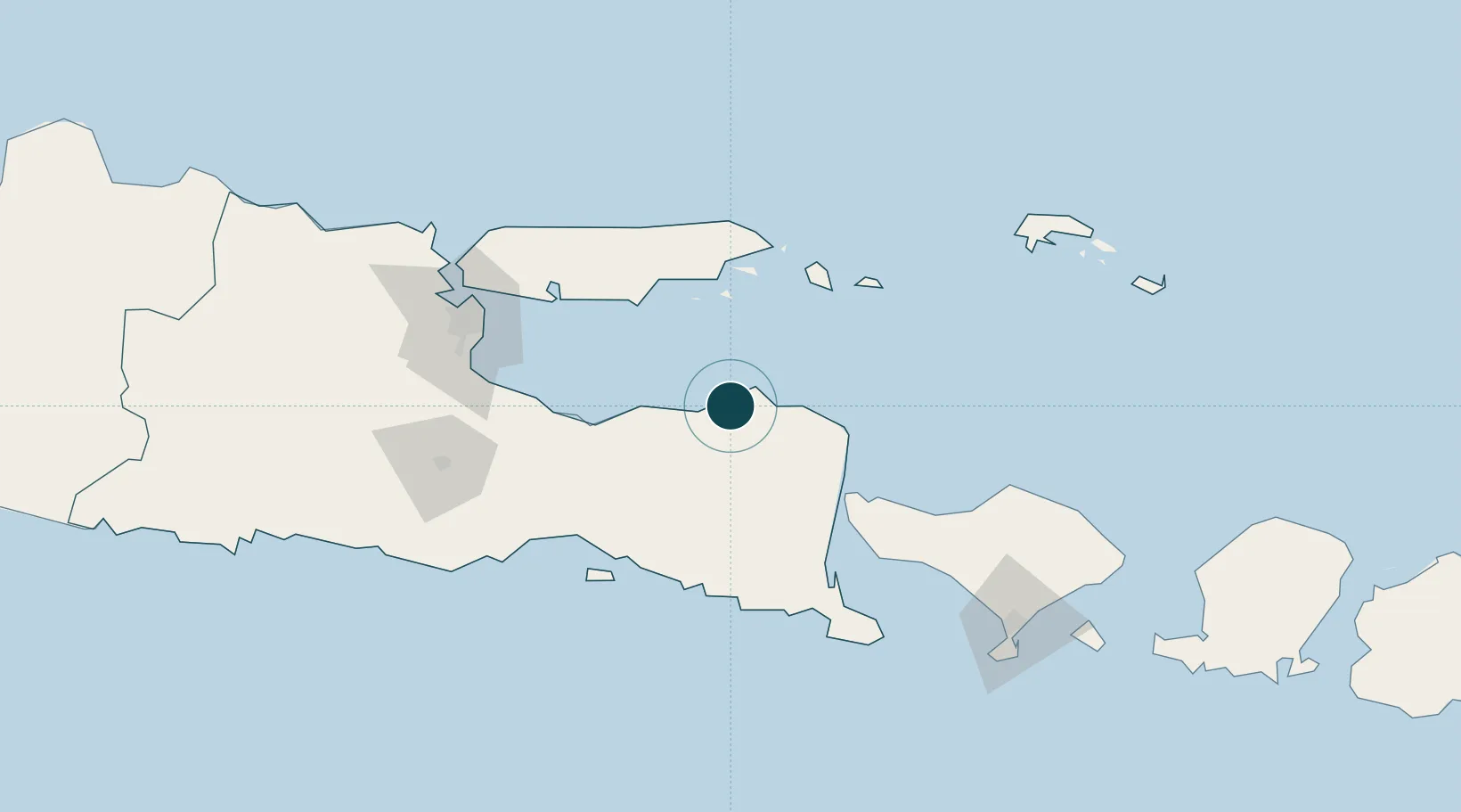
Nearby Logistics Neighbours

Ports
  1. 1Probolinggo79 km
  2. 2Celukan Bawang113 km
  3. 3Surabaya144 km
  4. 4Gresik154 km
  5. 5Poleng Oil Field162 km
Nearest neighbours — logibook spatial index (haversine) over the source coordinates
Cities
  1. 1Kalbut Situbondo11 km
  2. 2Banyuwangi72 km
  3. 3Sumenep72 km
  4. 4Jembrana108 km
  5. 5Pasuruan, Java114 km
Nearest neighbours — logibook spatial index (haversine) over the source coordinates
Airports
  1. 1Notohadinegoro Airport66 km
  2. 2Banyuwangi Airport81 km
  3. 3Lieutenant Colonel Wisnu Airfield90 km
  4. 4Juanda International Airport131 km
  5. 5Abdul Rachman Saleh Airport137 km
Nearest neighbours — logibook spatial index (haversine) over the source coordinates
Trade Zones
  1. 1Pasuruan Industrial Estate Rembang123 km
  2. 2Safe N Lock Industrial Estate133 km
  3. 3Surabaya Industrial Estate - Rungkut136 km
  4. 4Pulahan Seruai Industrial Estate143 km
  5. 5KEK Singhasari144 km
Nearest neighbours — logibook spatial index (haversine) over the source coordinates
DatabookThe Record of Consolidated Knowledge
Indonesia beyond logistics?
Browse databook

All Sources

Portsthe NGA World Port Index
Public domain (US gov)
AirportsOurAirports
Public domain
LocationsUN/LOCODE
UN/LOCODE — free
Trade Zonesthe World Bank SEZ database
CC BY 4.0
Trade ZonesOpen Zone Map
CC BY
← Indonesia ports