UN/LOCODE hub · South Africa
ZAZET

Stikland

-33.8833°, 18.6333°
1
Transport functions

Transport Functions

Multimodal
UN/LOCODE

Hub Profile

Region
WC
GeoNames

Location

Location of ZAZET
Natural Earth 10m (public domain) · WC · ZAZET · -33.88, 18.63GoogleOSMYandex

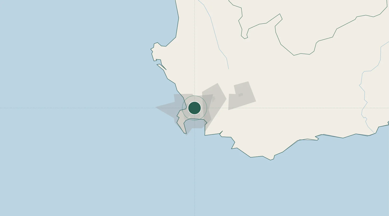
Nearby Logistics Neighbours

Cities
  1. 1Welgemoed2 km
  2. 2Stellenberg2 km
  3. 3Brackenfell5 km
  4. 4Elsiesriver7 km
  5. 5Goodwood8 km
Nearest neighbours — logibook spatial index (haversine) over the source coordinates
Ports
  1. 1Cape Town20 km
  2. 2Simonstown38 km
  3. 3Saldanha Bay113 km
  4. 4Mossel Bay325 km
  5. 5Port Elizabeth647 km
Nearest neighbours — logibook spatial index (haversine) over the source coordinates
Airports
  1. 1Cape Town International Airport10 km
  2. 2Ysterplaat Air Force Base13 km
  3. 3Langebaanweg Airport111 km
  4. 4Robertson Airport118 km
  5. 5Saldanha/Vredenburg Airport119 km
Nearest neighbours — logibook spatial index (haversine) over the source coordinates
Trade Zones
  1. 1Atlantis Special Economic Zone36 km
  2. 2Saldanha Bay Special Economic Zone111 km
  3. 3Namakwa (Nama-Khoi) Special Economic Zone519 km
  4. 4Coega Industrial Development Zone650 km
  5. 5Upington Special Economic Zone655 km
Nearest neighbours — logibook spatial index (haversine) over the source coordinates
DatabookThe Record of Consolidated Knowledge
South Africa beyond logistics?
Browse databook

All Sources

LocationsUN/LOCODE
UN/LOCODE — free
Portsthe NGA World Port Index
Public domain (US gov)
AirportsOurAirports
Public domain
Trade Zonesthe World Bank SEZ database
CC BY 4.0
Trade ZonesOpen Zone Map
CC BY
← South Africa locations