UN/LOCODE hub · South Africa
ZABAL

Ballito Bay

-29.5333°, 31.2167°
2
Transport functions

Transport Functions

Rail
Road
UN/LOCODE

Hub Profile

Region
KZN
GeoNames

Location

Location of ZABAL
Natural Earth 10m (public domain) · KZN · ZABAL · -29.53, 31.22GoogleOSMYandex

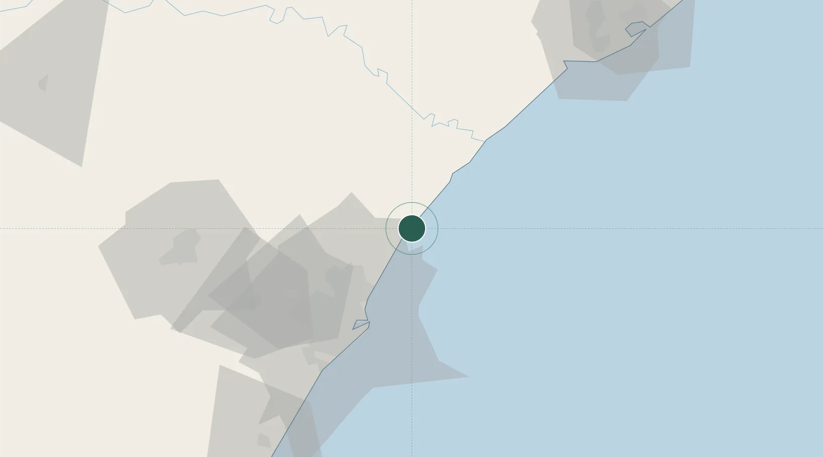
Nearby Logistics Neighbours

Cities
  1. 1Compensation5 km
  2. 2Canelands19 km
  3. 3Umhlanga Rocks24 km
  4. 4La Lucia28 km
  5. 5Briardene32 km
Nearest neighbours — logibook spatial index (haversine) over the source coordinates
Ports
  1. 1Durban40 km
  2. 2Richards Bay118 km
  3. 3Maputo418 km
  4. 4East London500 km
  5. 5Port Elizabeth720 km
Nearest neighbours — logibook spatial index (haversine) over the source coordinates
Airports
  1. 1King Shaka International Airport13 km
  2. 2Virginia Airport31 km
  3. 3Pietermaritzburg Airport80 km
  4. 4Richards Bay Airport122 km
  5. 5Prince Mangosuthu Buthelezi Airport136 km
Nearest neighbours — logibook spatial index (haversine) over the source coordinates
Trade Zones
  1. 1Durban Aerotropolis12 km
  2. 2Dube TradeZone13 km
  3. 3Dube AgriZone15 km
  4. 4Dube TradePort16 km
  5. 5Isithebe Industrial Park52 km
Nearest neighbours — logibook spatial index (haversine) over the source coordinates
DatabookThe Record of Consolidated Knowledge
South Africa beyond logistics?
Browse databook

All Sources

LocationsUN/LOCODE
UN/LOCODE — free
Portsthe NGA World Port Index
Public domain (US gov)
AirportsOurAirports
Public domain
Trade Zonesthe World Bank SEZ database
CC BY 4.0
Trade ZonesOpen Zone Map
CC BY
← South Africa locations