UN/LOCODE hub · South Africa
ZALUC

La Lucia

-29.7500°, 31.0667°
2
Transport functions

Transport Functions

Road
Multimodal
UN/LOCODE

Hub Profile

Place type
Populated place
GeoNames
Region
KwaZulu-Natal
GeoNames
Time zone
Africa/Johannesburg
GeoNames
Elevation
115 m
GeoNames

Location

Location of ZALUC
Natural Earth 10m (public domain) · KwaZulu-Natal · ZALUC · -29.75, 31.07GoogleOSMYandex

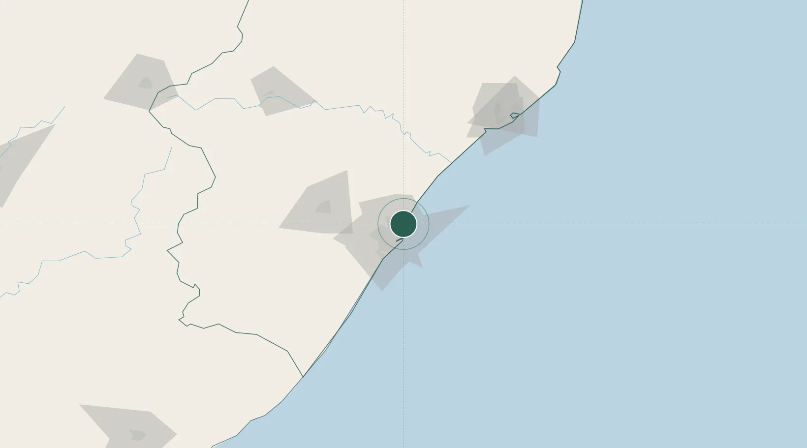
Nearby Logistics Neighbours

Cities
  1. 1Umhlanga Rocks4 km
  2. 2Briardene5 km
  3. 3Kwamashu8 km
  4. 4Stamford Hill9 km
  5. 5Sydenham11 km
Nearest neighbours — logibook spatial index (haversine) over the source coordinates
Ports
  1. 1Durban13 km
  2. 2Richards Bay145 km
  3. 3Maputo446 km
  4. 4East London472 km
  5. 5Port Elizabeth693 km
Nearest neighbours — logibook spatial index (haversine) over the source coordinates
Airports
  1. 1Virginia Airport2 km
  2. 2King Shaka International Airport16 km
  3. 3Pietermaritzburg Airport66 km
  4. 4Margate Airport141 km
  5. 5Richards Bay Airport150 km
Nearest neighbours — logibook spatial index (haversine) over the source coordinates
Trade Zones
  1. 1Dube TradePort14 km
  2. 2Dube AgriZone16 km
  3. 3Dube TradeZone17 km
  4. 4Durban Aerotropolis20 km
  5. 5Isithebe Industrial Park80 km
Nearest neighbours — logibook spatial index (haversine) over the source coordinates
DatabookThe Record of Consolidated Knowledge
South Africa beyond logistics?
Browse databook

All Sources

LocationsUN/LOCODE
UN/LOCODE — free
Portsthe NGA World Port Index
Public domain (US gov)
AirportsOurAirports
Public domain
Trade Zonesthe World Bank SEZ database
CC BY 4.0
Trade ZonesOpen Zone Map
CC BY
← South Africa locations