UN/LOCODE hub · United States
USZFQ

Vermont

34.1500°, -118.4833°
646
Population
1
Transport functions

Transport Functions

Multimodal
UN/LOCODE

Hub Profile

Place type
Populated place
GeoNames
Region
Illinois
GeoNames
Population
646
GeoNames
Time zone
America/Chicago
GeoNames
Elevation
211 m
GeoNames

Location

Location of USZFQ
Natural Earth 10m (public domain) · Illinois · USZFQ · 34.15, -118.48GoogleOSMYandex

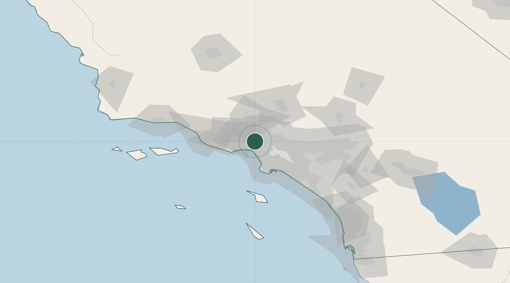
Nearby Logistics Neighbours

Cities
  1. 1North Hills9 km
  2. 2Westwood13 km
  3. 3Playa Vista21 km
  4. 4Newhall26 km
  5. 5Saugus30 km
Nearest neighbours — logibook spatial index (haversine) over the source coordinates
Ports
  1. 1El Segundo26 km
  2. 2Los Angeles49 km
  3. 3Long Beach51 km
  4. 4Port Hueneme66 km
  5. 5Ventura75 km
Nearest neighbours — logibook spatial index (haversine) over the source coordinates
Airports
  1. 1Van Nuys Airport7 km
  2. 2Hollywood Burbank Airport13 km
  3. 3Santa Monica Municipal Airport15 km
  4. 4Los Angeles International Airport24 km
  5. 5Jack Northrop Field Hawthorne Municipal Airport29 km
Nearest neighbours — logibook spatial index (haversine) over the source coordinates
Trade Zones
  1. 1FTZ No. 202 Los Angeles49 km
  2. 2FTZ No. 050 Long Beach50 km
  3. 3FTZ No. 191 Palmdale58 km
  4. 4FTZ No. 205 Port Hueneme66 km
  5. 5FTZ No. 243 Victorville113 km
Nearest neighbours — logibook spatial index (haversine) over the source coordinates
DatabookThe Record of Consolidated Knowledge
United States beyond logistics?
Browse databook

All Sources

LocationsUN/LOCODE
UN/LOCODE — free
LocationsGeoNames
CC BY 4.0
Portsthe NGA World Port Index
Public domain (US gov)
AirportsOurAirports
Public domain
Trade Zonesthe World Bank SEZ database
CC BY 4.0
Trade ZonesOpen Zone Map
CC BY
← United States locations