UN/LOCODE hub · United States
USPDG

Playa Vista

33.9667°, -118.4167°
1
Transport functions

Transport Functions

Multimodal
UN/LOCODE

Hub Profile

Place type
Urban district
GeoNames
Region
California
GeoNames
Time zone
America/Los_Angeles
GeoNames
Elevation
2 m
GeoNames

Location

Location of USPDG
Natural Earth 10m (public domain) · California · USPDG · 33.97, -118.42GoogleOSMYandex

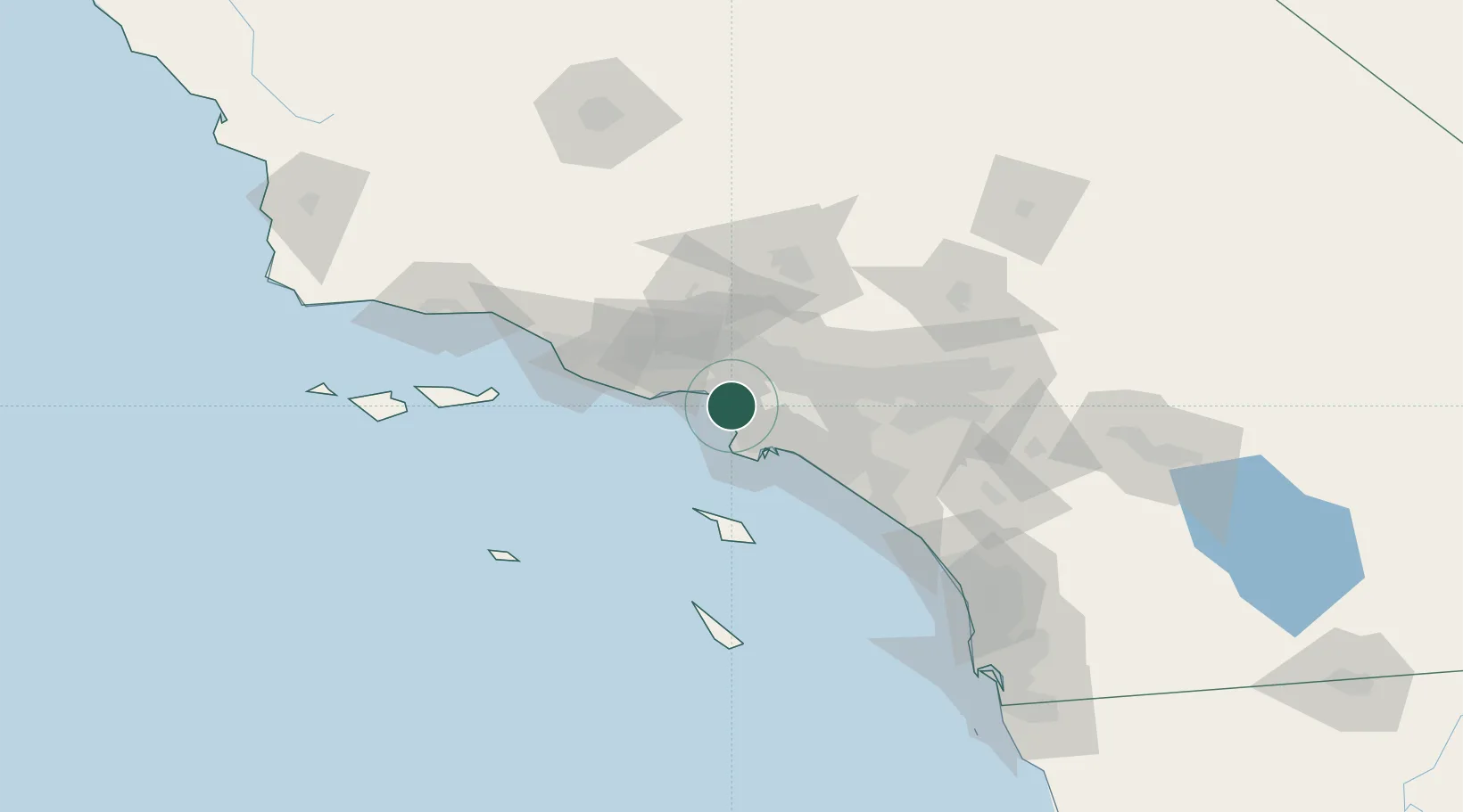
Nearby Logistics Neighbours

Cities
  1. 1Westwood9 km
  2. 2South Gate20 km
  3. 3Vermont21 km
  4. 4Los Angeles24 km
  5. 5Commerce/Los Angeles24 km
Nearest neighbours — logibook spatial index (haversine) over the source coordinates
Ports
  1. 1El Segundo6 km
  2. 2Los Angeles29 km
  3. 3Long Beach31 km
  4. 4Newport Beach62 km
  5. 5Avalon69 km
Nearest neighbours — logibook spatial index (haversine) over the source coordinates
Airports
  1. 1Los Angeles International Airport3 km
  2. 2Santa Monica Municipal Airport6 km
  3. 3Jack Northrop Field Hawthorne Municipal Airport9 km
  4. 4Hollywood Burbank Airport27 km
  5. 5Van Nuys Airport28 km
Nearest neighbours — logibook spatial index (haversine) over the source coordinates
Trade Zones
  1. 1FTZ No. 202 Los Angeles28 km
  2. 2FTZ No. 050 Long Beach31 km
  3. 3FTZ No. 191 Palmdale73 km
  4. 4FTZ No. 205 Port Hueneme75 km
  5. 5FTZ No. 244 Riverside County104 km
Nearest neighbours — logibook spatial index (haversine) over the source coordinates
DatabookThe Record of Consolidated Knowledge
United States beyond logistics?
Browse databook

All Sources

LocationsUN/LOCODE
UN/LOCODE — free
Portsthe NGA World Port Index
Public domain (US gov)
AirportsOurAirports
Public domain
Trade Zonesthe World Bank SEZ database
CC BY 4.0
Trade ZonesOpen Zone Map
CC BY
← United States locations