UN/LOCODE hub · United States
USVBW

Bristow

38.8000°, -77.2000°
2
Transport functions

Transport Functions

Rail
Road
UN/LOCODE

Hub Profile

Place type
Populated place
GeoNames
Region
Virginia
GeoNames
Time zone
America/New_York
GeoNames
Elevation
91 m
GeoNames

Location

Location of USVBW
Natural Earth 10m (public domain) · Virginia · USVBW · 38.80, -77.20GoogleOSMYandex

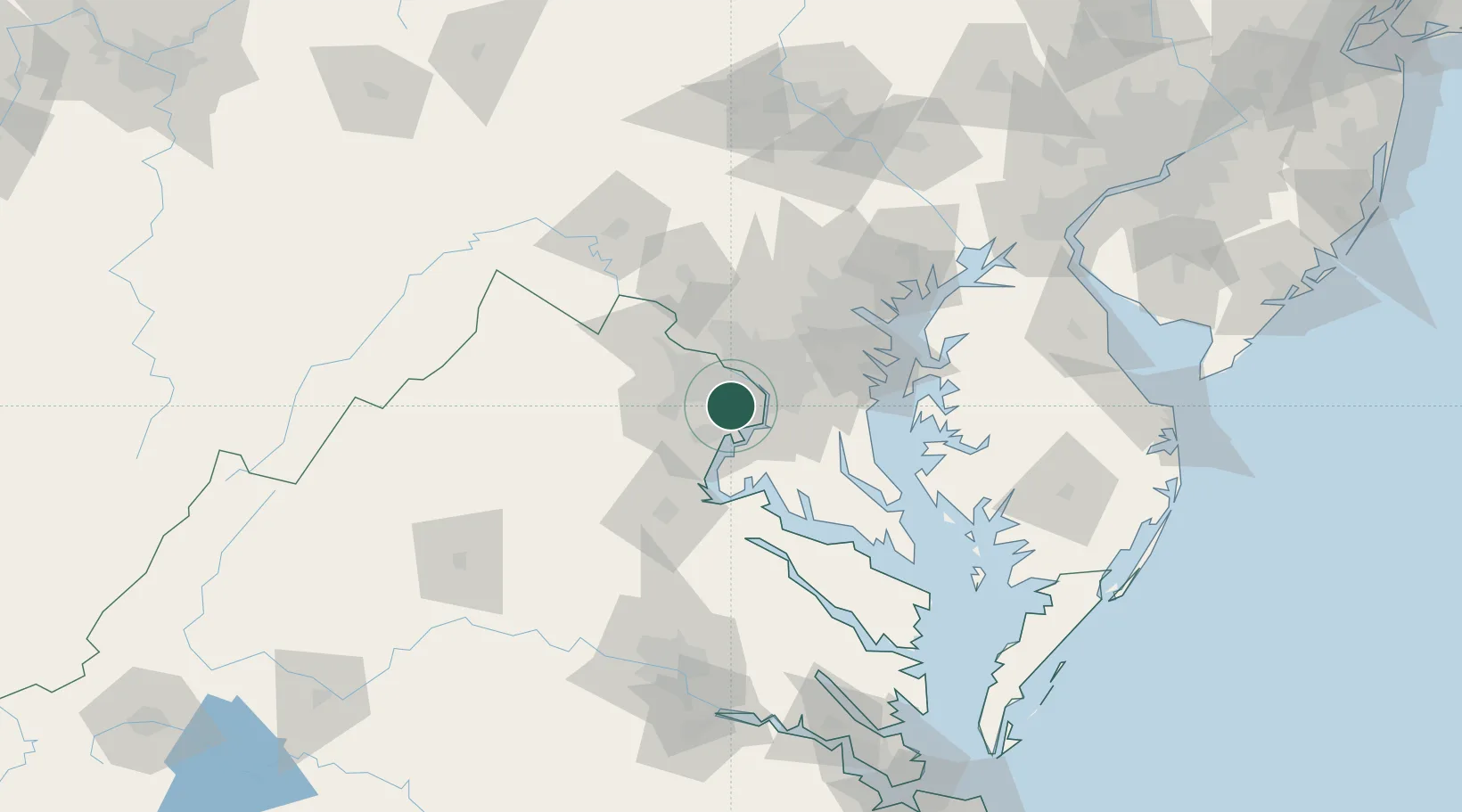
Nearby Logistics Neighbours

Cities
  1. 1Willston7 km
  2. 2Oakton13 km
  3. 3Alexandria14 km
  4. 4Langley15 km
  5. 5Chevy Chase21 km
Nearest neighbours — logibook spatial index (haversine) over the source coordinates
Ports
  1. 1Alexandria14 km
  2. 2Washington D.C.16 km
  3. 3Fredericksburg60 km
  4. 4Annapolis65 km
  5. 5Baltimore74 km
Nearest neighbours — logibook spatial index (haversine) over the source coordinates
Airports
  1. 1Davison Army Air Field10 km
  2. 2Ronald Reagan Washington National Airport15 km
  3. 3Washington Dulles International Airport27 km
  4. 4Manassas Regional Airport/Harry P. Davis Field29 km
  5. 5Joint Base Andrews29 km
Nearest neighbours — logibook spatial index (haversine) over the source coordinates
Trade Zones
  1. 1FTZ No. 063 PrInce Georges County5 km
  2. 2FTZ No. 137 Washington Dulles International Airport28 km
  3. 3FTZ No. 073 BWI Airport62 km
  4. 4FTZ No. 074 Baltimore73 km
  5. 5FTZ No. 185 Culpeper County82 km
Nearest neighbours — logibook spatial index (haversine) over the source coordinates
DatabookThe Record of Consolidated Knowledge
United States beyond logistics?
Browse databook

All Sources

LocationsUN/LOCODE
UN/LOCODE — free
Portsthe NGA World Port Index
Public domain (US gov)
AirportsOurAirports
Public domain
Trade Zonesthe World Bank SEZ database
CC BY 4.0
Trade ZonesOpen Zone Map
CC BY
← United States locations