UN/LOCODE hub · United States
USMT4

Millerton

41.9500°, -73.5167°
940
Population
2
Transport functions

Transport Functions

Rail
Road
UN/LOCODE

Hub Profile

Place type
Populated place
GeoNames
Region
New York
GeoNames
Population
940
GeoNames
Time zone
America/New_York
GeoNames
Elevation
216 m
GeoNames

Location

Location of USMT4
Natural Earth 10m (public domain) · New York · USMT4 · 41.95, -73.52GoogleOSMYandex

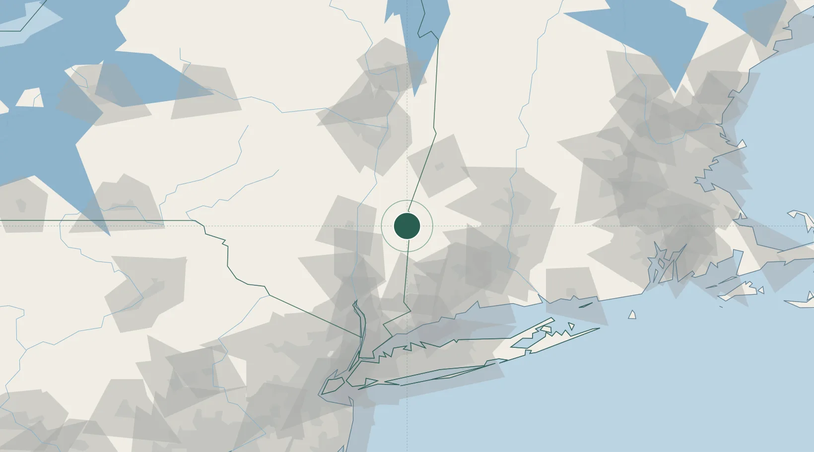
Nearby Logistics Neighbours

Cities
  1. 1Salisbury9 km
  2. 2Pine Plains11 km
  3. 3Ancram15 km
  4. 4Canaan17 km
  5. 5Copake Falls19 km
Nearest neighbours — logibook spatial index (haversine) over the source coordinates
Ports
  1. 1Kingston37 km
  2. 2Catskill40 km
  3. 3Poughkeepsie45 km
  4. 4Newburgh64 km
  5. 5Albany80 km
Nearest neighbours — logibook spatial index (haversine) over the source coordinates
Airports
  1. 1Dutchess County Airport47 km
  2. 2Danbury Municipal Airport64 km
  3. 3Bradley International Airport69 km
  4. 4New York Stewart International Airport70 km
  5. 5Westfield-Barnes Regional Airport70 km
Nearest neighbours — logibook spatial index (haversine) over the source coordinates
Trade Zones
  1. 1FTZ No. 201 Holyoke73 km
  2. 2FTZ No. 071 Windsor Locks73 km
  3. 3FTZ No. 162 New Haven87 km
  4. 4FTZ No. 121 Albany89 km
  5. 5FTZ No. 076 Bridgeport90 km
Nearest neighbours — logibook spatial index (haversine) over the source coordinates
DatabookThe Record of Consolidated Knowledge
United States beyond logistics?
Browse databook

All Sources

LocationsUN/LOCODE
UN/LOCODE — free
LocationsGeoNames
CC BY 4.0
Portsthe NGA World Port Index
Public domain (US gov)
AirportsOurAirports
Public domain
Trade Zonesthe World Bank SEZ database
CC BY 4.0
Trade ZonesOpen Zone Map
CC BY
← United States locations