Seaport · United States

CatskillUSACG

42.2167°, -73.8500°
1.8 m
Channel depth

Channel & Berth Profile

SEA LEVEL (CD)CHANNEL BEDChannel · 1.8 mCargo pier · 4.9 mAnchorage · 11.0 m
NGA World Port Index

Pilotage, Tugs & Services

Pilotage compulsoryYES
Tug assistanceYES
Potable waterYES
Diesel bunkersYES
MedicalYES
NGA World Port Index

Facilities & Capabilities

Container
Ro-Ro
Liquid bulk
Dry bulk
Oil terminal
Break bulk
Dry dockNO
RepairsNO
BunkeringYES
Rail linkYES
Dangerous cargo
ISPS security
NGA World Port Index

Harbour Specifications

Harbour size
Very Small
NGA World Port Index
Harbour type
River (Natural)
NGA World Port Index
Shelter
Good
NGA World Port Index
Water body
North Atlantic Ocean
NGA World Port Index
Tidal range
1.2 m
NGA World Port Index
Overhead limit
Yes
NGA World Port Index
Pilotage
Yes
NGA World Port Index

Location

Location of USACG
Natural Earth 10m (public domain) · New York · USACG · 42.22, -73.85GoogleOSMYandex

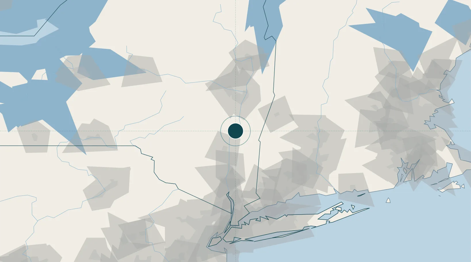
Nearby Logistics Neighbours

Ports
  1. 1Kingston33 km
  2. 2Albany49 km
  3. 3Rensselaer49 km
  4. 4Poughkeepsie58 km
  5. 5Troy59 km
Nearest neighbours — logibook spatial index (haversine) over the source coordinates
Cities
  1. 1Coxsackie, Greene15 km
  2. 2Philmont17 km
  3. 3Ghent23 km
  4. 4East Durham25 km
  5. 5Ancram26 km
Nearest neighbours — logibook spatial index (haversine) over the source coordinates
Airports
  1. 1Albany International Airport59 km
  2. 2Dutchess County Airport66 km
  3. 3Schenectady County Airport71 km
  4. 4New York Stewart International Airport82 km
  5. 5Westfield-Barnes Regional Airport94 km
Nearest neighbours — logibook spatial index (haversine) over the source coordinates
Trade Zones
  1. 1FTZ No. 121 Albany56 km
  2. 2FTZ No. 201 Holyoke94 km
  3. 3FTZ No. 071 Windsor Locks106 km
  4. 4FTZ No. 268 Brattleboro125 km
  5. 5FTZ No. 162 New Haven127 km
Nearest neighbours — logibook spatial index (haversine) over the source coordinates
DatabookThe Record of Consolidated Knowledge
United States beyond logistics?
Browse databook

All Sources

Portsthe NGA World Port Index
Public domain (US gov)
AirportsOurAirports
Public domain
LocationsUN/LOCODE
UN/LOCODE — free
Trade Zonesthe World Bank SEZ database
CC BY 4.0
Trade ZonesOpen Zone Map
CC BY
← United States ports