UN/LOCODE hub · United States
USGCU

Grand Chute

44.2833°, -88.4333°
2
Transport functions

Transport Functions

Road
Multimodal
UN/LOCODE

Hub Profile

Region
WI
GeoNames

Location

Location of USGCU
Natural Earth 10m (public domain) · WI · USGCU · 44.28, -88.43GoogleOSMYandex

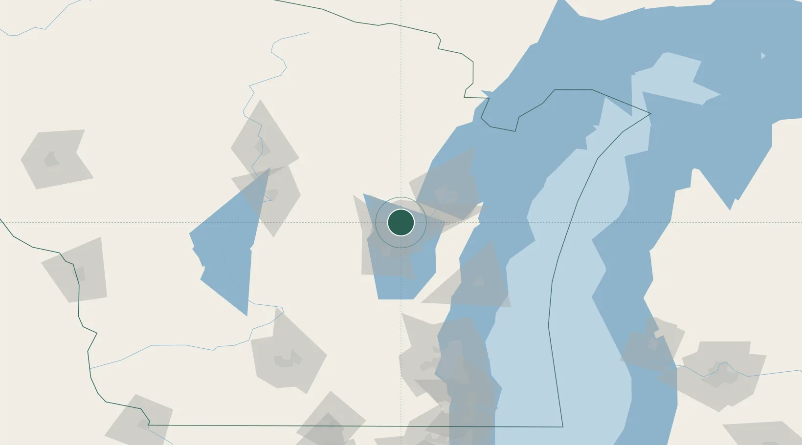
Nearby Logistics Neighbours

Cities
  1. 1Dale19 km
  2. 2Wrightstown22 km
  3. 3Holland22 km
  4. 4Winneconne30 km
  5. 5Ashwaubenon35 km
Nearest neighbours — logibook spatial index (haversine) over the source coordinates
Ports
  1. 1Kaukauna13 km
  2. 2Green Bay42 km
  3. 3Manitowoc66 km
  4. 4Two Rivers71 km
  5. 5Kewaunee77 km
Nearest neighbours — logibook spatial index (haversine) over the source coordinates
Airports
  1. 1Appleton International Airport7 km
  2. 2Austin Straubel International Airport33 km
  3. 3Wittman Regional Airport35 km
  4. 4Central Wisconsin Airport112 km
  5. 5Wausau Downtown Airport119 km
Nearest neighbours — logibook spatial index (haversine) over the source coordinates
Trade Zones
  1. 1FTZ No. 167 Brown County23 km
  2. 2FTZ No. 041 Milwaukee139 km
  3. 3FTZ No. 266 Dane County169 km
  4. 4FTZ No. 019 Omaha174 km
  5. 5FTZ No. 189 Kent Ottawa/Muskegon Counties208 km
Nearest neighbours — logibook spatial index (haversine) over the source coordinates
DatabookThe Record of Consolidated Knowledge
United States beyond logistics?
Browse databook

All Sources

LocationsUN/LOCODE
UN/LOCODE — free
Portsthe NGA World Port Index
Public domain (US gov)
AirportsOurAirports
Public domain
Trade Zonesthe World Bank SEZ database
CC BY 4.0
Trade ZonesOpen Zone Map
CC BY
← United States locations