UN/LOCODE hub · United States
USCY7

Camp Shelby

31.1667°, -89.2000°
1
Transport functions

Transport Functions

Multimodal
UN/LOCODE

Hub Profile

Region
MS
GeoNames

Location

Location of USCY7
Natural Earth 10m (public domain) · MS · USCY7 · 31.17, -89.20GoogleOSMYandex

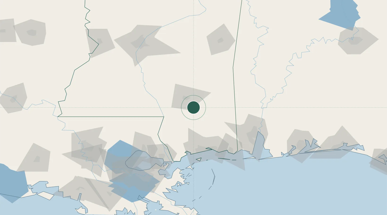
Nearby Logistics Neighbours

Cities
  1. 1New Augusta16 km
  2. 2Petal20 km
  3. 3Richton31 km
  4. 4Moselle38 km
  5. 5Sumrall, Lamar42 km
Nearest neighbours — logibook spatial index (haversine) over the source coordinates
Ports
  1. 1Gulfport92 km
  2. 2Biloxi92 km
  3. 3Pascagoula109 km
  4. 4Slidell115 km
  5. 5Mobile117 km
Nearest neighbours — logibook spatial index (haversine) over the source coordinates
Airports
  1. 1Hattiesburg Bobby L Chain Municipal Airport12 km
  2. 2Hattiesburg Laurel Regional Airport36 km
  3. 3Gulfport Biloxi International Airport86 km
  4. 4Keesler Air Force Base88 km
  5. 5Mobile Regional Airport106 km
Nearest neighbours — logibook spatial index (haversine) over the source coordinates
Trade Zones
  1. 1FTZ No. 092 Harrison County86 km
  2. 2FTZ No. 082 Mobile119 km
  3. 3FTZ No. 002 New Orleans160 km
  4. 4FTZ No. 124 Gramercy190 km
  5. 5FTZ No. 158 Vicksburg Jackson197 km
Nearest neighbours — logibook spatial index (haversine) over the source coordinates
DatabookThe Record of Consolidated Knowledge
United States beyond logistics?
Browse databook

All Sources

LocationsUN/LOCODE
UN/LOCODE — free
Portsthe NGA World Port Index
Public domain (US gov)
AirportsOurAirports
Public domain
Trade Zonesthe World Bank SEZ database
CC BY 4.0
Trade ZonesOpen Zone Map
CC BY
← United States locations