UN/LOCODE hub · United States
USUAL

Sumrall, Lamar

31.4167°, -89.5333°
2
Transport functions

Transport Functions

Road
Multimodal
UN/LOCODE

Hub Profile

Region
MS
GeoNames

Location

Location of USUAL
Natural Earth 10m (public domain) · MS · USUAL · 31.42, -89.53GoogleOSMYandex

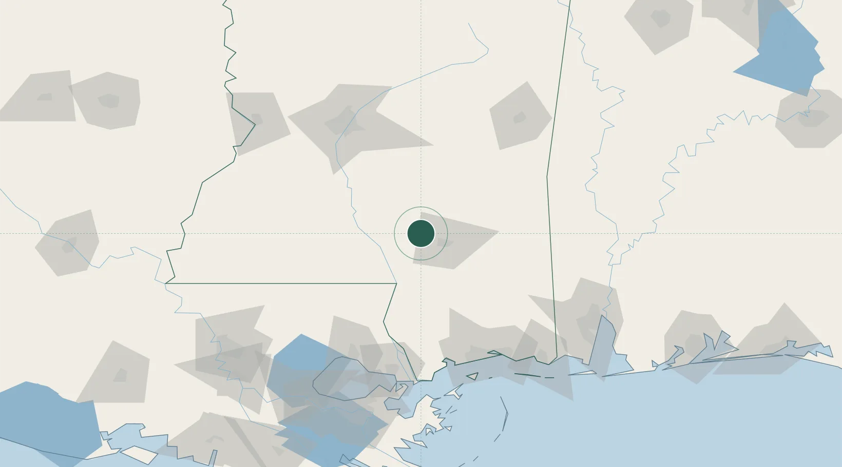
Nearby Logistics Neighbours

Cities
  1. 1Seminary17 km
  2. 2Bassfield19 km
  3. 3Moselle27 km
  4. 4Petal27 km
  5. 5Carson27 km
Nearest neighbours — logibook spatial index (haversine) over the source coordinates
Ports
  1. 1Gulfport126 km
  2. 2Madisonville127 km
  3. 3Slidell130 km
  4. 4Biloxi131 km
  5. 5Pascagoula150 km
Nearest neighbours — logibook spatial index (haversine) over the source coordinates
Trade Zones
  1. 1FTZ No. 092 Harrison County124 km
  2. 2FTZ No. 158 Vicksburg Jackson155 km
  3. 3FTZ No. 082 Mobile160 km
  4. 4FTZ No. 002 New Orleans172 km
  5. 5FTZ No. 124 Gramercy188 km
Nearest neighbours — logibook spatial index (haversine) over the source coordinates
DatabookThe Record of Consolidated Knowledge
United States beyond logistics?
Browse databook

All Sources

LocationsUN/LOCODE
UN/LOCODE — free
Portsthe NGA World Port Index
Public domain (US gov)
AirportsOurAirports
Public domain
Trade Zonesthe World Bank SEZ database
CC BY 4.0
Trade ZonesOpen Zone Map
CC BY
← United States locations