UN/LOCODE hub · United Kingdom
GBTAB

Tarbert,Harris

57.9000°, -6.8000°
1
Transport functions

Transport Functions

Port
UN/LOCODE

Hub Profile

Region
ELS
GeoNames

Location

Location of GBTAB
Natural Earth 10m (public domain) · ELS · GBTAB · 57.90, -6.80GoogleOSMYandex

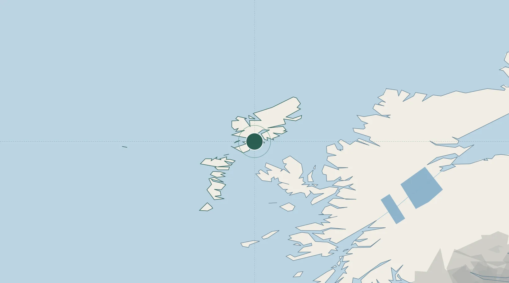
Nearby Logistics Neighbours

Cities
  1. 1North Harris4 km
  2. 2Scalpay, Outer Hebridies8 km
  3. 3Leverburgh, Harris20 km
  4. 4Eishken26 km
  5. 5North Lochs29 km
Nearest neighbours — logibook spatial index (haversine) over the source coordinates
Ports
  1. 1Tarbert1 km
  2. 2Lochmaddy40 km
  3. 3Stornoway Harbor41 km
  4. 4Uig44 km
  5. 5Portree Harbor65 km
Nearest neighbours — logibook spatial index (haversine) over the source coordinates
Airports
  1. 1Stornoway Airport45 km
  2. 2Benbecula Airport57 km
  3. 3Barra Airport105 km
  4. 4Coll Airport145 km
  5. 5Tiree Airport156 km
Nearest neighbours — logibook spatial index (haversine) over the source coordinates
Trade Zones
  1. 1Prestwick Airport Free Zone298 km
  2. 2Carlisle Kingmoor Park Enterprise Zone405 km
  3. 3Isle of Man Free Zone and Business Park445 km
  4. 4Dublin International Financial Services Centre507 km
  5. 5Blackpool Enterprise Zone516 km
Nearest neighbours — logibook spatial index (haversine) over the source coordinates
DatabookThe Record of Consolidated Knowledge
United Kingdom beyond logistics?
Browse databook

All Sources

LocationsUN/LOCODE
UN/LOCODE — free
Portsthe NGA World Port Index
Public domain (US gov)
AirportsOurAirports
Public domain
Trade Zonesthe World Bank SEZ database
CC BY 4.0
Trade ZonesOpen Zone Map
CC BY
← United Kingdom locations