UN/LOCODE hub · United Kingdom
GBACV

Cove (Aberdeen)

57.1000°, -2.0667°
1
Transport functions

Transport Functions

Port
UN/LOCODE

Hub Profile

Region
ABD
GeoNames

Location

Location of GBACV
Natural Earth 10m (public domain) · ABD · GBACV · 57.10, -2.07GoogleOSMYandex

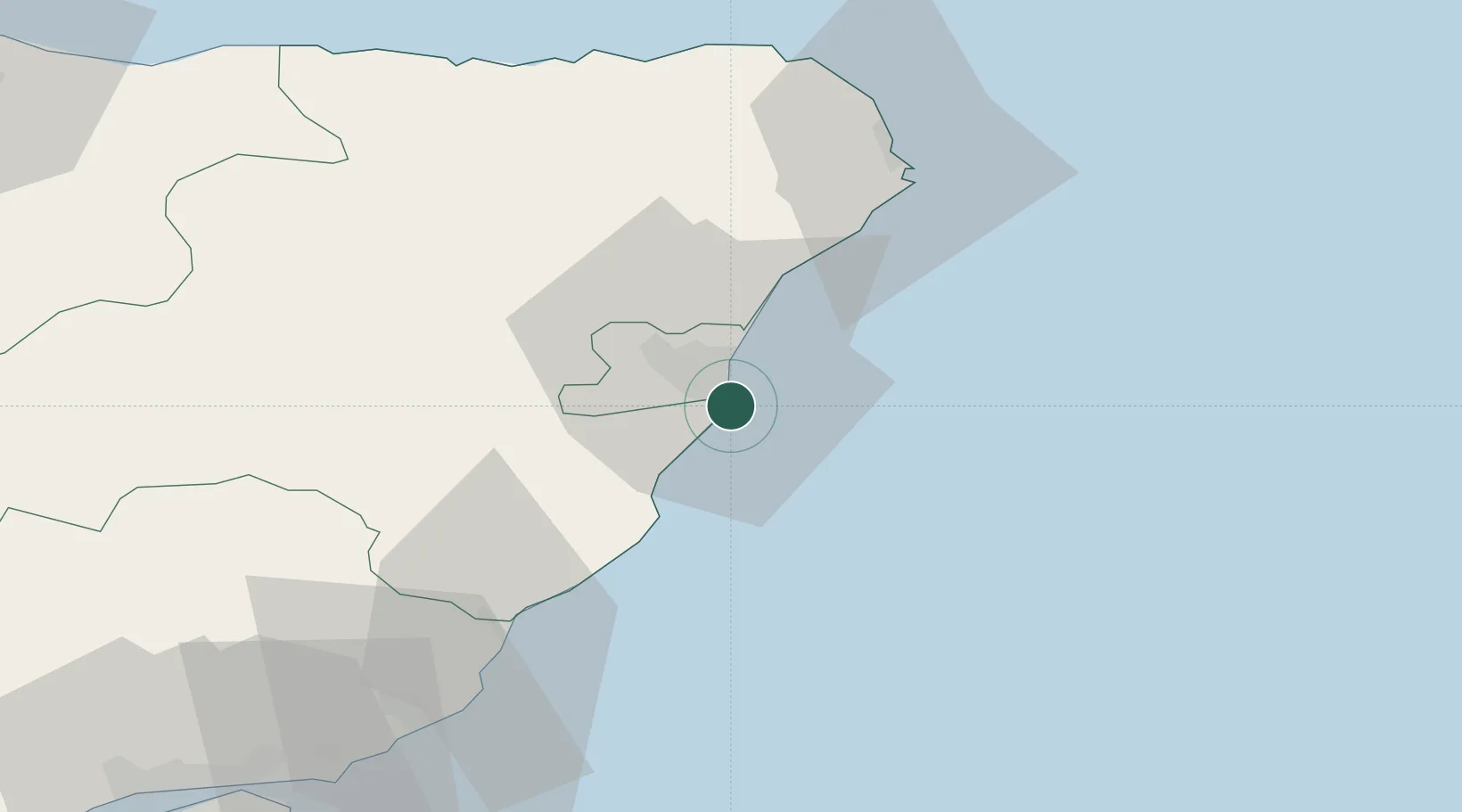
Nearby Logistics Neighbours

Cities
  1. 1Aberdeen7 km
  2. 2Bucksburn10 km
  3. 3Stoneywood11 km
  4. 4Peterculter12 km
  5. 5Stonehaven17 km
Nearest neighbours — logibook spatial index (haversine) over the source coordinates
Ports
  1. 1Aberdeen6 km
  2. 2Peterhead48 km
  3. 3Montrose51 km
  4. 4Fraserburgh Harbor65 km
  5. 5Macduff68 km
Nearest neighbours — logibook spatial index (haversine) over the source coordinates
Airports
  1. 1Aberdeen International Airport14 km
  2. 2Dundee Airport93 km
  3. 3Leuchars Station Airfield94 km
  4. 4RAF Lossiemouth102 km
  5. 5Inverness Airport129 km
Nearest neighbours — logibook spatial index (haversine) over the source coordinates
Trade Zones
  1. 1Prestwick Airport Free Zone237 km
  2. 2North Eastern Enterprise Zone239 km
  3. 3Carlisle Kingmoor Park Enterprise Zone247 km
  4. 4Tees Valley Enterprise Zone283 km
  5. 5York Central Enterprise Zone355 km
Nearest neighbours — logibook spatial index (haversine) over the source coordinates
DatabookThe Record of Consolidated Knowledge
United Kingdom beyond logistics?
Browse databook

All Sources

LocationsUN/LOCODE
UN/LOCODE — free
Portsthe NGA World Port Index
Public domain (US gov)
AirportsOurAirports
Public domain
Trade Zonesthe World Bank SEZ database
CC BY 4.0
Trade ZonesOpen Zone Map
CC BY
← United Kingdom locations