UN/LOCODE hub · France
FRWGX

Agneaux

49.1167°, -1.1000°
5,017
Population
1
Transport functions

Transport Functions

Multimodal
UN/LOCODE

Hub Profile

Place type
Populated place
GeoNames
Region
Normandy
GeoNames
Population
5,017
GeoNames
Time zone
Europe/Paris
GeoNames
Elevation
47 m
GeoNames

Location

Location of FRWGX
Natural Earth 10m (public domain) · Normandy · FRWGX · 49.12, -1.10GoogleOSMYandex

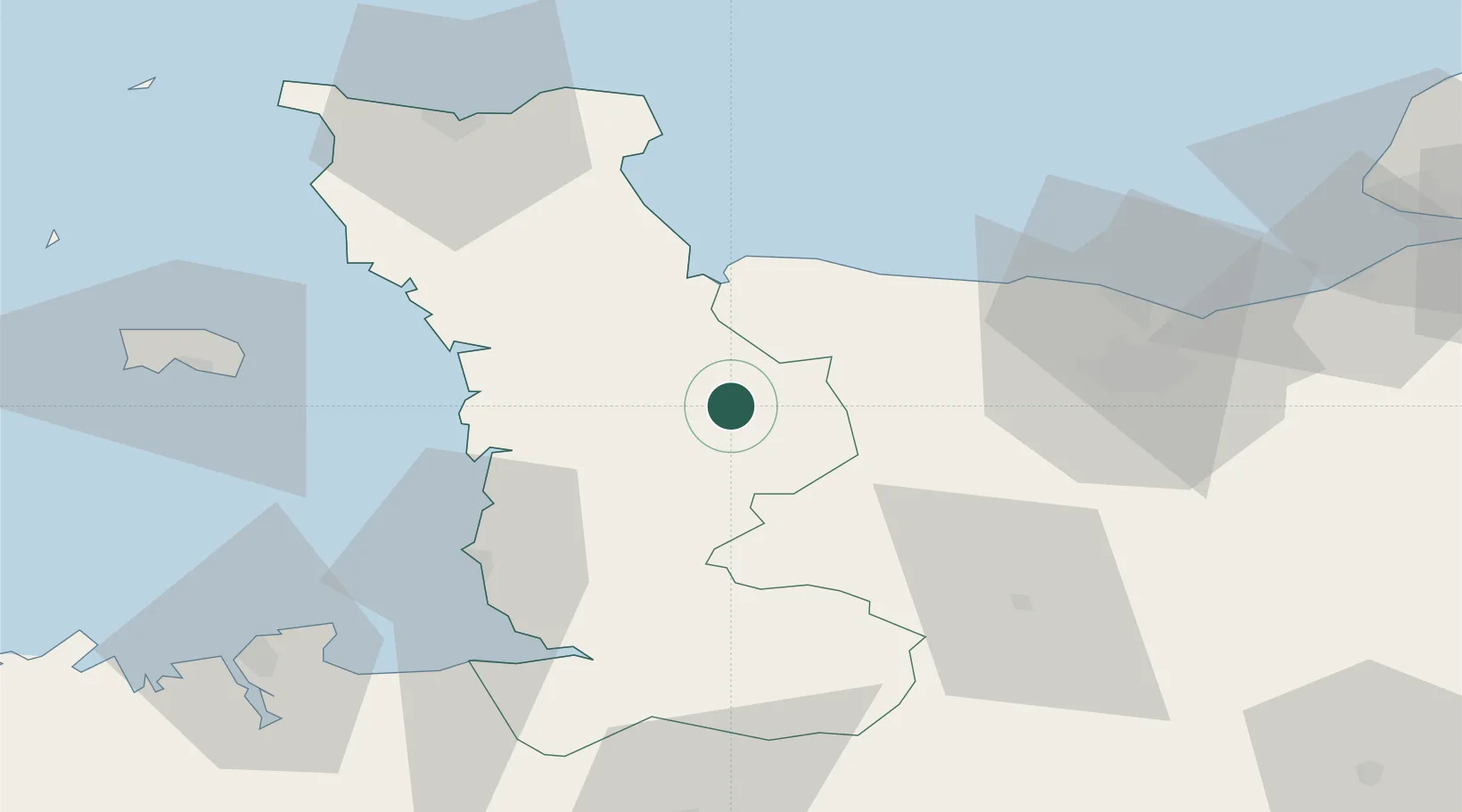
Nearby Logistics Neighbours

Cities
  1. 1Saint-Lô1 km
  2. 2Saint-Amand12 km
  3. 3Tessy-sur-Vire17 km
  4. 4Isigny-sur-Mer20 km
  5. 5Carentan23 km
Nearest neighbours — logibook spatial index (haversine) over the source coordinates
Ports
  1. 1Granville48 km
  2. 2Port De Caen55 km
  3. 3Ouistreham65 km
  4. 4Rade De Cherbourg71 km
  5. 5Saint Helier Harbour74 km
Nearest neighbours — logibook spatial index (haversine) over the source coordinates
Airports
  1. 1Granville Airport43 km
  2. 2Caen Carpiquet airport47 km
  3. 3Cherbourg Manche airport65 km
  4. 4Jersey Airport80 km
  5. 5Dinard Pleurtuit Saint-Malo airport93 km
Nearest neighbours — logibook spatial index (haversine) over the source coordinates
Trade Zones
  1. 1ZFU La Guérinière, La Grâce de Dieu51 km
  2. 2ZFU Hérouville-Saint-Clair55 km
  3. 3ZFU Cherbourg-Octeville71 km
  4. 4ZFU Le Havre98 km
  5. 5ZFU Alençon115 km
Nearest neighbours — logibook spatial index (haversine) over the source coordinates
DatabookThe Record of Consolidated Knowledge
France beyond logistics?
Browse databook

All Sources

LocationsUN/LOCODE
UN/LOCODE — free
LocationsGeoNames
CC BY 4.0
Portsthe NGA World Port Index
Public domain (US gov)
AirportsOurAirports
Public domain
Trade Zonesthe World Bank SEZ database
CC BY 4.0
Trade ZonesOpen Zone Map
CC BY
← France locations