Free Trade Zone · Vietnam

Nam Phu Yen Coastal Economic Zone Active
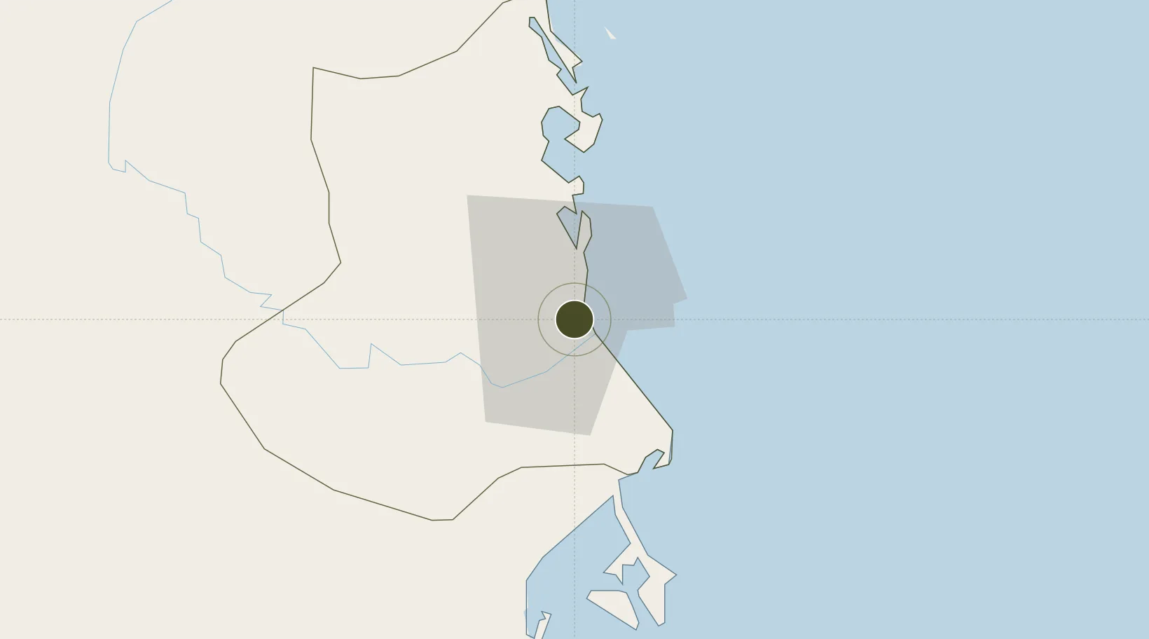
13.1100°, 109.2906°
20,730 ha
Zone area
73.3 km
Nearest port
8.2 km
Nearest airport

Gateway access

Nearest neighbours — logibook spatial index (haversine) over the source coordinates

Zone profile

Zone type
Free Trade Zone
Open Zone Map
Region
Phú Yên
Open Zone Map
Status
Active
Open Zone Map
Management
Public
Open Zone Map
Operator
Management Board of Infrastructure Investment of PhuYen Economic Zone
Open Zone Map
Legal framework
Decision No. 53/2008/QD-TTg, Decision No. 1353/QD-TTg dated September 23, 2008,
Open Zone Map

Location

Location of ozm-5186
Natural Earth 10m (public domain) · Phú Yên · ozm-5186 · 13.11, 109.29GoogleOSMYandex

Nearby Logistics Neighbours

Ports
  1. 1Qui Nhon73 km
  2. 2Nha Trang96 km
  3. 3Vinh Cam Ranh137 km
  4. 4Da Nang352 km
  5. 5Phu My373 km
Nearest neighbours — logibook spatial index (haversine) over the source coordinates
Airports
  1. 1Dong Tac Airport8 km
  2. 2Phu Cat Airport98 km
  3. 3Cam Ranh International Airport / Cam Ranh Air Base124 km
  4. 4Buon Ma Thuot Airport136 km
  5. 5Pleiku Airport170 km
Nearest neighbours — logibook spatial index (haversine) over the source coordinates
Cities
  1. 1Vung Ro32 km
  2. 2Dam Mon51 km
  3. 3Trung Hoa57 km
  4. 4Ninh Hòa72 km
  5. 5Thi Nai Port73 km
Nearest neighbours — logibook spatial index (haversine) over the source coordinates
Trade Zones
  1. 1Hoa Hiep Phase I Industrial Zone13 km
  2. 2Van Phong Coastal Economic Zone43 km
  3. 3Hòa Hiệp 1 Industrial Zone47 km
  4. 4Van Phong Economic Zone53 km
  5. 5Ninh Thuy Industrial Zone67 km
Nearest neighbours — logibook spatial index (haversine) over the source coordinates
DatabookThe Record of Consolidated Knowledge
Vietnam beyond logistics?
Browse databook

All Sources

Trade ZonesOpen Zone Map
CC BY
Portsthe NGA World Port Index
Public domain (US gov)
AirportsOurAirports
Public domain
LocationsUN/LOCODE
UN/LOCODE — free
← Vietnam trade zones