Foreign Trade Zone · United States

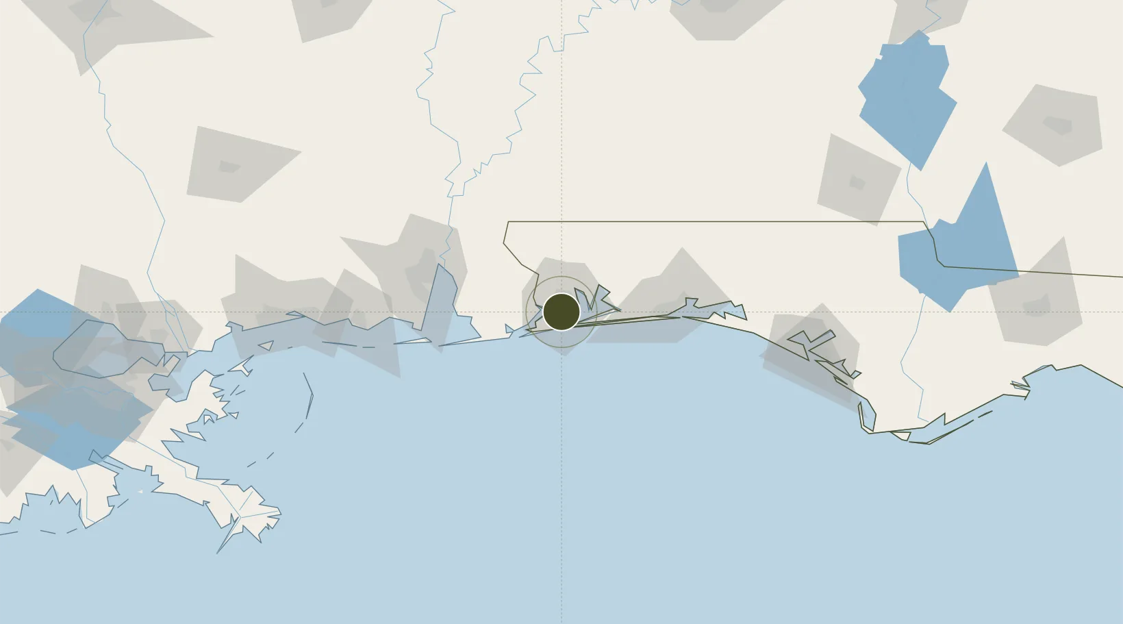
FTZ No. 249 Pensacola Active

30.4369°, -87.2628°
1,670 ha
Zone area
6.0 km
Nearest port
8.3 km
Nearest airport

Gateway access

Nearest neighbours — logibook spatial index (haversine) over the source coordinates

Zone profile

Zone type
Foreign Trade Zone
Open Zone Map
Region
Florida
Open Zone Map
Status
Active
Open Zone Map
Management
Public
Open Zone Map
Operator
Pensacola-Escambia County Promotion and Development Commission
Open Zone Map
Legal framework
Foreign-Trade Zones Act
Open Zone Map

Location

Location of ozm-4726
Natural Earth 10m (public domain) · Florida · ozm-4726 · 30.44, -87.26GoogleOSMYandex

Nearby Logistics Neighbours

Ports
  1. 1Pensacola6 km
  2. 2Mobile86 km
  3. 3Pascagoula125 km
  4. 4Biloxi156 km
  5. 5Panama City159 km
Nearest neighbours — logibook spatial index (haversine) over the source coordinates
Airports
  1. 1Pensacola International Airport8 km
  2. 2Naval Air Station Pensacola Forrest Sherman Field11 km
  3. 3Whiting Field Naval Air Station South Airport38 km
  4. 4Whiting Field Naval Air Station - North39 km
  5. 5Hurlburt Field55 km
Nearest neighbours — logibook spatial index (haversine) over the source coordinates
Cities
  1. 1Gulf Breeze13 km
  2. 2Pensacola Beach17 km
  3. 3Cantonment17 km
  4. 4Orange Beach34 km
  5. 5Navarre40 km
Nearest neighbours — logibook spatial index (haversine) over the source coordinates
Trade Zones
  1. 1FTZ No. 082 Mobile84 km
  2. 2FTZ No. 065 Panama City148 km
  3. 3FTZ No. 092 Harrison County164 km
  4. 4FTZ No. 233 Dothan196 km
  5. 5FTZ No. 222 Montgomery234 km
Nearest neighbours — logibook spatial index (haversine) over the source coordinates
DatabookThe Record of Consolidated Knowledge
United States beyond logistics?
Browse databook

All Sources

Trade ZonesOpen Zone Map
CC BY
Portsthe NGA World Port Index
Public domain (US gov)
AirportsOurAirports
Public domain
LocationsUN/LOCODE
UN/LOCODE — free
← United States trade zones