Free Trade Zone · Saudi Arabia

NEOM Under Development
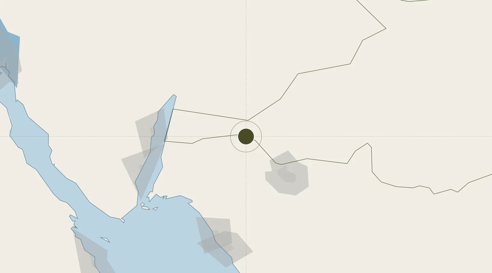
28.9604°, 35.9881°
2,600,000 ha
Zone area
114.1 km
Nearest port
90.3 km
Nearest airport

Gateway access

Nearest neighbours — logibook spatial index (haversine) over the source coordinates

Zone profile

Zone type
Free Trade Zone
Open Zone Map
Region
Al Jawf
Open Zone Map
Status
Under Development
Open Zone Map
Management
Public
Open Zone Map
Operator
Saudi Arabia Public Investment Fund
Open Zone Map
Legal framework
Unavailable
Open Zone Map

Location

Location of ozm-4104
Natural Earth 10m (public domain) · Al Jawf · ozm-4104 · 28.96, 35.99GoogleOSMYandex

Nearby Logistics Neighbours

Ports
  1. 1Al Aqabah114 km
  2. 2Elat120 km
  3. 3Nuwaybi'130 km
  4. 4Duba161 km
  5. 5Sharm El Sheikh208 km
Nearest neighbours — logibook spatial index (haversine) over the source coordinates
Airports
  1. 1Prince Sultan bin Abdulaziz International Airport90 km
  2. 2King Hussein International Airport119 km
  3. 3Ramon International Airport127 km
  4. 4Neom Bay Airport134 km
  5. 5Taba International Airport137 km
Nearest neighbours — logibook spatial index (haversine) over the source coordinates
Cities
  1. 1Al 'Aqabah110 km
  2. 2'Aqaba114 km
  3. 3Red Sea Security120 km
  4. 4Al Khuraibah129 km
  5. 5Nuwaiba130 km
Nearest neighbours — logibook spatial index (haversine) over the source coordinates
Trade Zones
  1. 1Tabuk Tabō«k Industrial City82 km
  2. 2Aqaba Special Economic Zone115 km
  3. 3Aqaba International Industrial Estate117 km
  4. 4Eilat Free Port Zone121 km
  5. 5Shkhoret Industrial Zone125 km
Nearest neighbours — logibook spatial index (haversine) over the source coordinates
DatabookThe Record of Consolidated Knowledge
Saudi Arabia beyond logistics?
Browse databook

All Sources

Trade ZonesOpen Zone Map
CC BY
Portsthe NGA World Port Index
Public domain (US gov)
AirportsOurAirports
Public domain
LocationsUN/LOCODE
UN/LOCODE — free
← Saudi Arabia trade zones