Free Zone · Malaysia

Pasir Gudang Free Zone Active
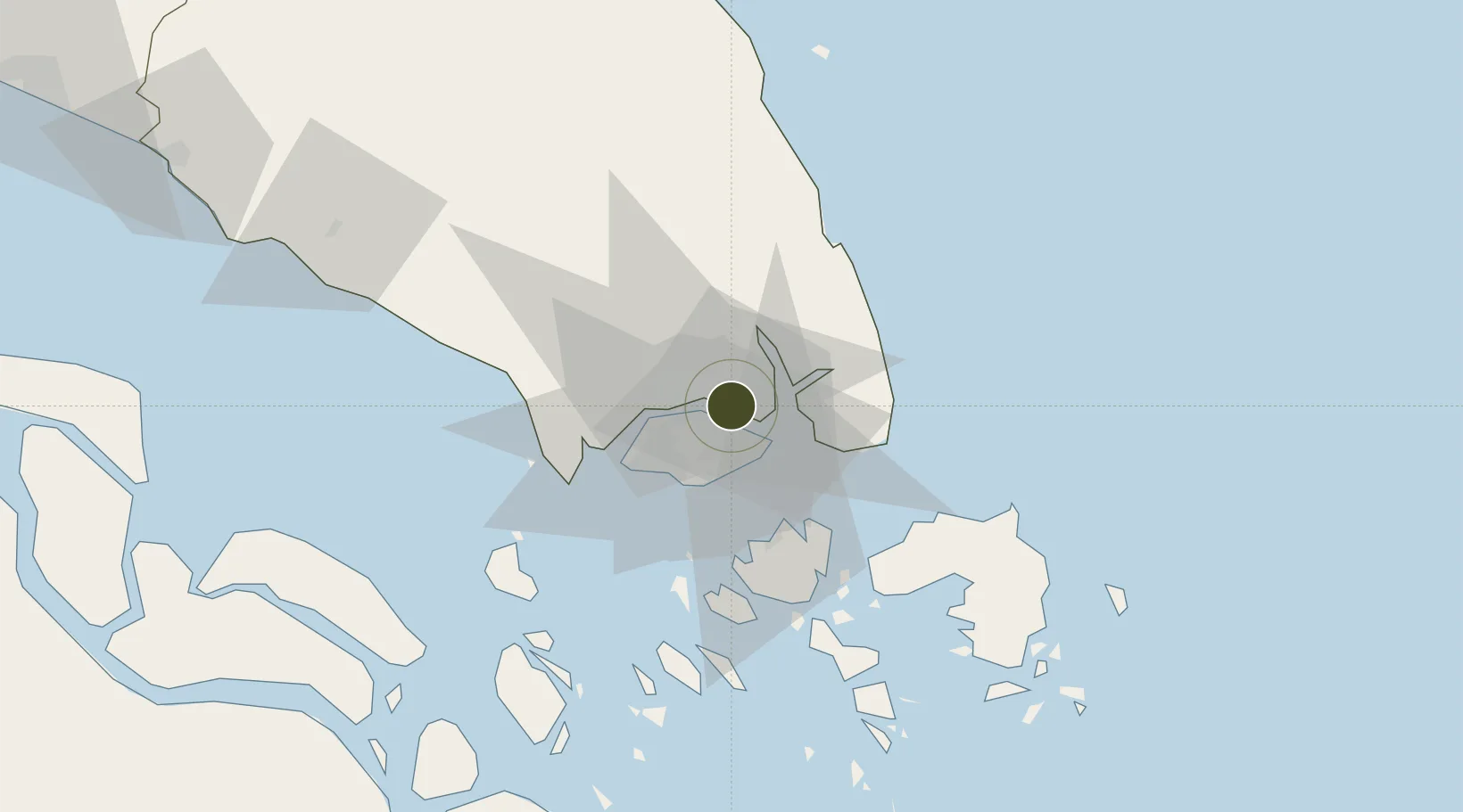
1.4578°, 103.9054°
75 ha
Zone area
2.8 km
Nearest port
6.4 km
Nearest airport

Gateway access

Nearest neighbours — logibook spatial index (haversine) over the source coordinates

Zone profile

Zone type
Free Zone
the World Bank SEZ database
Region
Johor
the World Bank SEZ database
Status
Active
the World Bank SEZ database
Established
1984
the World Bank SEZ database
Management
Private management
the World Bank SEZ database
Operator
Johor Port Berhad
the World Bank SEZ database
Regulatory authority
Ministry of International Trade and Industry
the World Bank SEZ database
Legal framework
Free Zones Act
the World Bank SEZ database

Location

Location of MYS2
Natural Earth 10m (public domain) · Johor · MYS2 · 1.46, 103.91GoogleOSMYandex

Fiscal & incentives

Corporate tax
24%
the World Bank SEZ database
Tax relief
No exemption
the World Bank SEZ database
Relief duration
No exemption
the World Bank SEZ database
VAT
No exemption
the World Bank SEZ database
Import duty (inputs)
100% exempt
the World Bank SEZ database
Import duty (capex)
100% exempt
the World Bank SEZ database
Profit repatriation
100% exempt from repatriation tax on earnings
the World Bank SEZ database
Capital gains
No exemption
the World Bank SEZ database
Withholding tax
No exemption
the World Bank SEZ database
Min. investment
None
the World Bank SEZ database
Min. export
80%
the World Bank SEZ database
Employment incentive
No exemption
the World Bank SEZ database
Developer incentive
No established framework
the World Bank SEZ database

Nearby Logistics Neighbours

Ports
  1. 1Johor3 km
  2. 2Keppel - (East Singapore)20 km
  3. 3Jurong Island27 km
  4. 4Pulau Bukom29 km
  5. 5Pulau Sebarok31 km
Nearest neighbours — logibook spatial index (haversine) over the source coordinates
Airports
  1. 1Seletar Airport6 km
  2. 2Paya Lebar Air Base11 km
  3. 3Sembawang Air Base11 km
  4. 4Singapore Changi Airport16 km
  5. 5Changi Air Base (East)17 km
Nearest neighbours — logibook spatial index (haversine) over the source coordinates
Cities
  1. 1Pasir Gudang, Johor2 km
  2. 2Johor Bahru3 km
  3. 3Kampung Tanjung Langsat12 km
  4. 4Taman Molek16 km
  5. 5Changi19 km
Nearest neighbours — logibook spatial index (haversine) over the source coordinates
Trade Zones
  1. 1Punggol Digital District5 km
  2. 2Eastern Gate Development Flagship Zone5 km
  3. 3Pasir Gudang Free Industrial Zone6 km
  4. 4Iskandar Halal Park8 km
  5. 5Tanjung Langsat Commercial Free Zone8 km
Nearest neighbours — logibook spatial index (haversine) over the source coordinates
DatabookThe Record of Consolidated Knowledge
Malaysia beyond logistics?
Browse databook

All Sources

Trade Zonesthe World Bank SEZ database
CC BY 4.0
Portsthe NGA World Port Index
Public domain (US gov)
AirportsOurAirports
Public domain
LocationsUN/LOCODE
UN/LOCODE — free
← Malaysia trade zones