UN/LOCODE hub · Malaysia
MYTLA

Kampung Tanjung Langsat

1.4667°, 104.0167°
1
Transport functions

Transport Functions

Port
UN/LOCODE

Hub Profile

Place type
Populated place
GeoNames
Region
Johor
GeoNames
Time zone
Asia/Kuala_Lumpur
GeoNames
Elevation
21 m
GeoNames

Location

Location of MYTLA
Natural Earth 10m (public domain) · Johor · MYTLA · 1.47, 104.02GoogleOSMYandex

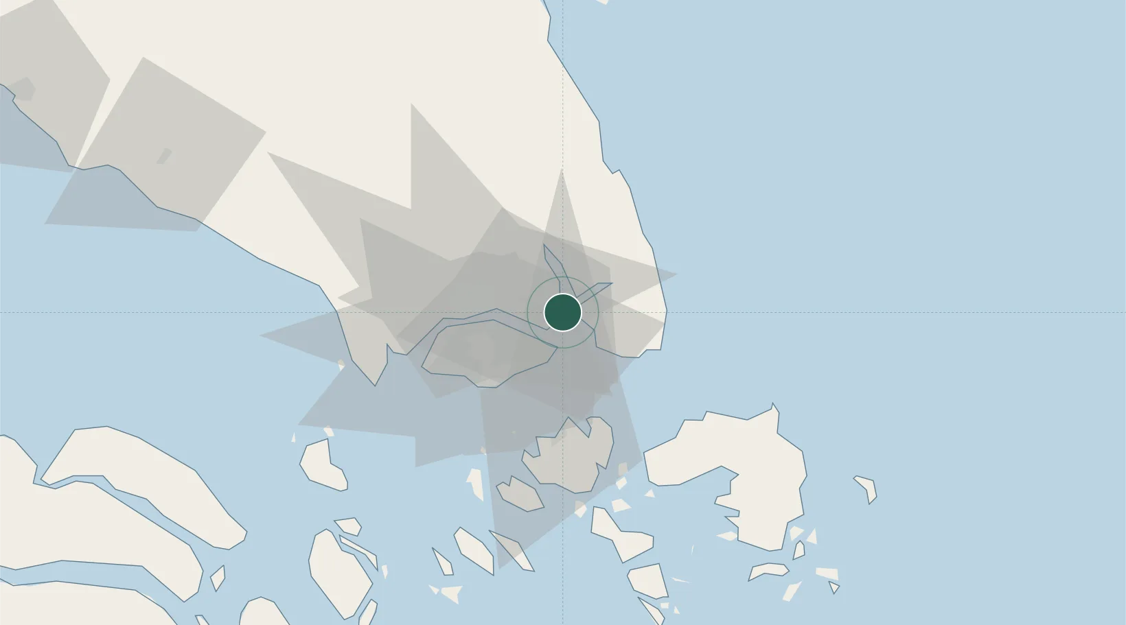
Nearby Logistics Neighbours

Cities
  1. 1Pasir Gudang, Johor14 km
  2. 2Johor Bahru15 km
  3. 3Pengerang16 km
  4. 4Changi17 km
  5. 5Taman Molek26 km
Nearest neighbours — logibook spatial index (haversine) over the source coordinates
Ports
  1. 1Johor14 km
  2. 2Keppel - (East Singapore)28 km
  3. 3Pulau Sambu36 km
  4. 4Jurong Island38 km
  5. 5Pulau Bukom38 km
Nearest neighbours — logibook spatial index (haversine) over the source coordinates
Airports
  1. 1Singapore Changi Airport13 km
  2. 2Changi Air Base (East)14 km
  3. 3Paya Lebar Air Base17 km
  4. 4Seletar Airport18 km
  5. 5Sembawang Air Base23 km
Nearest neighbours — logibook spatial index (haversine) over the source coordinates
Trade Zones
  1. 1Tanjung Langsat Commercial Free Zone5 km
  2. 2Airport Logistics Park Of Singapore11 km
  3. 3Changi Airport Free Trade Zone12 km
  4. 4Iskandar Halal Park12 km
  5. 5Pasir Gudang Free Zone12 km
Nearest neighbours — logibook spatial index (haversine) over the source coordinates
DatabookThe Record of Consolidated Knowledge
Malaysia beyond logistics?
Browse databook

All Sources

LocationsUN/LOCODE
UN/LOCODE — free
Portsthe NGA World Port Index
Public domain (US gov)
AirportsOurAirports
Public domain
Trade Zonesthe World Bank SEZ database
CC BY 4.0
Trade ZonesOpen Zone Map
CC BY
← Malaysia locations