UN/LOCODE hub · Malaysia
MYJHB

Johor Bahru

1.4641°, 103.8799°
858,118
Population
2
Transport functions

Transport Functions

Port
Airport
Johor Bahru is also a profiled seaport →
UN/LOCODE

Hub Profile

Place type
Regional capital
GeoNames
Region
Johor
GeoNames
Population
858,118
GeoNames
Time zone
Asia/Kuala_Lumpur
GeoNames
Elevation
32 m
GeoNames
Logistics facilities
4
UN/LOCODE

Location

Location of MYJHB
Natural Earth 10m (public domain) · Johor · MYJHB · 1.46, 103.88GoogleOSMYandex

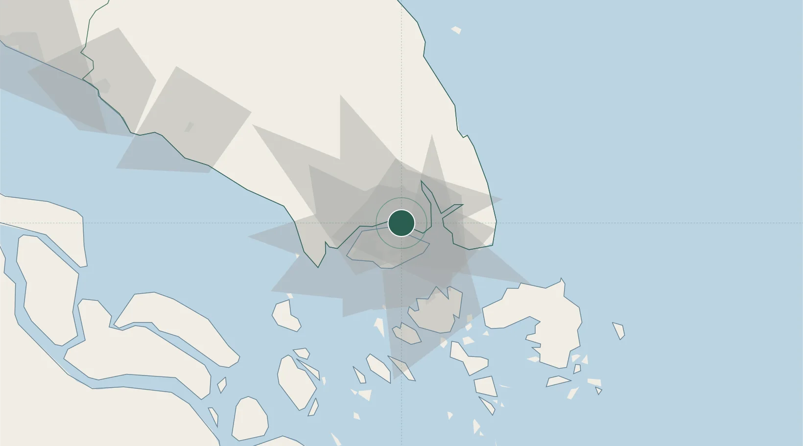
Nearby Logistics Neighbours

Cities
  1. 1Pasir Gudang, Johor2 km
  2. 2Taman Molek13 km
  3. 3Kampung Tanjung Langsat15 km
  4. 4Ulu Tiram20 km
  5. 5Choa Chu Kang20 km
Nearest neighbours — logibook spatial index (haversine) over the source coordinates
Ports
  1. 1Keppel - (East Singapore)20 km
  2. 2Jurong Island26 km
  3. 3Pulau Bukom29 km
  4. 4Pulau Sebarok31 km
  5. 5Pulau Sambu33 km
Nearest neighbours — logibook spatial index (haversine) over the source coordinates
Airports
  1. 1Seletar Airport6 km
  2. 2Sembawang Air Base9 km
  3. 3Paya Lebar Air Base12 km
  4. 4Singapore Changi Airport18 km
  5. 5Changi Air Base (East)20 km
Nearest neighbours — logibook spatial index (haversine) over the source coordinates
Trade Zones
  1. 1Eastern Gate Development Flagship Zone3 km
  2. 2Pasir Gudang Free Zone3 km
  3. 3Pasir Gudang Free Industrial Zone3 km
  4. 4Sembawang Wharves Free Trade Zone5 km
  5. 5Punggol Digital District6 km
Nearest neighbours — logibook spatial index (haversine) over the source coordinates
DatabookThe Record of Consolidated Knowledge
Malaysia beyond logistics?
Browse databook

All Sources

LocationsUN/LOCODE
UN/LOCODE — free
LocationsGeoNames
CC BY 4.0
Portsthe NGA World Port Index
Public domain (US gov)
AirportsOurAirports
Public domain
Trade Zonesthe World Bank SEZ database
CC BY 4.0
Trade ZonesOpen Zone Map
CC BY
← Malaysia locations