Seaport · Brazil

Porto SantanaBRSTN

-0.0500°, -51.1833°
9.4 m
Channel depth

Channel & Berth Profile

SEA LEVEL (CD)CHANNEL BEDOil terminal · 6.4 mChannel · 9.4 mCargo pier · 9.4 mAnchorage · 22.0 m
NGA World Port Index

Pilotage, Tugs & Services

Pilotage compulsoryYES
Pilotage availableYES
Tug assistanceNO
Salvage tugsNO
Shore powerYES
Potable waterYES
MedicalYES
NGA World Port Index

Facilities & Capabilities

Container
Ro-Ro
Liquid bulk
Dry bulk
Oil terminal
Break bulk
Dry dock
RepairsNO
Bunkering
Rail linkYES
Dangerous cargo
ISPS security
NGA World Port Index

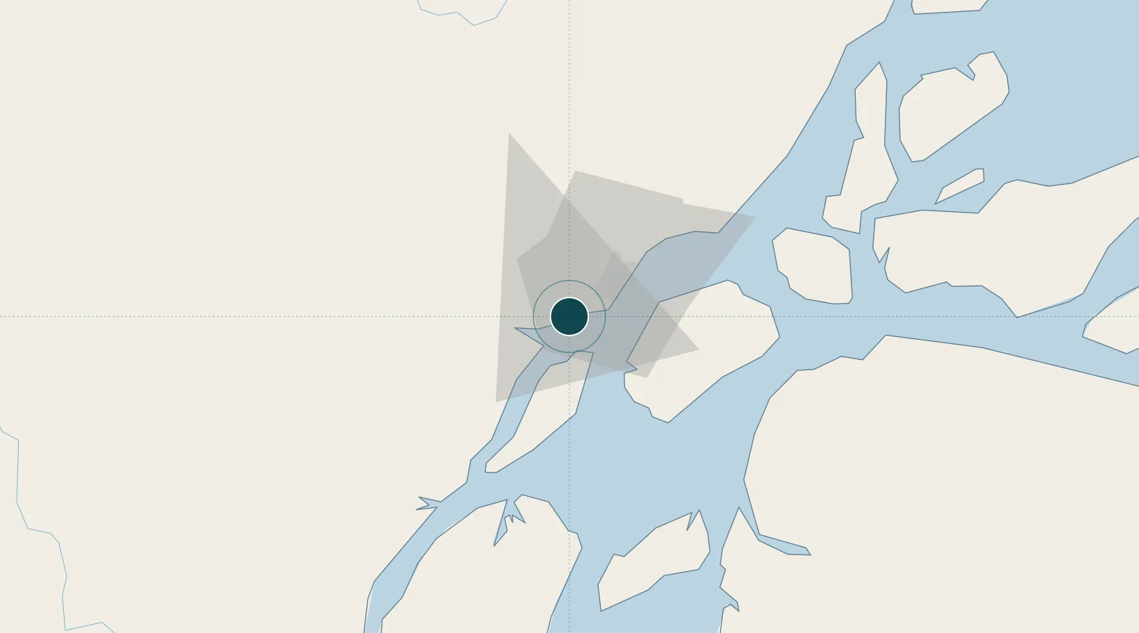
Harbour Specifications

Harbour size
Very Small
NGA World Port Index
Harbour type
River (Natural)
NGA World Port Index
Shelter
Good
NGA World Port Index
Water body
South Atlantic Ocean
NGA World Port Index
Tidal range
3.4 m
NGA World Port Index
Pilotage
Yes
NGA World Port Index

Location

Location of BRSTN
Natural Earth 10m (public domain) · Amapá · BRSTN · -0.05, -51.18GoogleOSMYandex

Nearby Logistics Neighbours

Ports
  1. 1Cameta308 km
  2. 2Vila Do Conde318 km
  3. 3Belem337 km
  4. 4Santarem473 km
  5. 5Degrad Des Cannes558 km
Nearest neighbours — logibook spatial index (haversine) over the source coordinates
Cities
  1. 1Santana Pt / Macapá2 km
  2. 2Afuá90 km
  3. 3Chaves134 km
  4. 4Gurupá158 km
  5. 5Laranjal do Jari175 km
Nearest neighbours — logibook spatial index (haversine) over the source coordinates
Airports
  1. 1Macapá - Alberto Alcolumbre International Airport17 km
  2. 2Monte Dourado - Serra do Areão Airport183 km
  3. 3Breves Airport195 km
  4. 4Almeirim Airport222 km
  5. 5Val de Cans/Júlio Cezar Ribeiro International Airport335 km
Nearest neighbours — logibook spatial index (haversine) over the source coordinates
Trade Zones
  1. 1ZPE de Barcarena (PA)328 km
  2. 2ZPE de São Luís812 km
  3. 3ZPE de Araguaína (TO)858 km
  4. 4Lethem Industrial Estate1031 km
  5. 5Zona Franca de Manaus - Suframa (Manaus Free Zone)1035 km
Nearest neighbours — logibook spatial index (haversine) over the source coordinates
DatabookThe Record of Consolidated Knowledge
Brazil beyond logistics?
Browse databook

All Sources

Portsthe NGA World Port Index
Public domain (US gov)
AirportsOurAirports
Public domain
LocationsUN/LOCODE
UN/LOCODE — free
Trade Zonesthe World Bank SEZ database
CC BY 4.0
Trade ZonesOpen Zone Map
CC BY
← Brazil ports